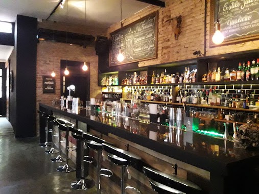
Bar nearby Santa María
Argentina
Bar nearby Santa María
Santa María
1905, Juramento, 1428, Comuna 13, Buenos Aires, AR Argentina
contacts phone
:
+54 11 4783-5353
website:
www.barsantamaria.com.ar
Latitude:
-34.5592952
, Longitude:
-58.452234
larger map & directions
read more
nearest Bar
92 m
El Árbol
Galería el Arbol, O'Higgins 2125
Bar
read more
221 m
Wrangler's Saloon Western Pub
Juramento 2121
Bar
read more
284 m
Gate One Bar
Juramento 1667, 1428
Bar
read more
284 m
Gate One Bar
Juramento 1667
Bar
read more
443 m
Profesor de Piano y Teclado Lic. Gustavo Rodriguez Galicia
Cuba 2370
Bar
read more
454 m
Casa Watson
Vuelta de Obligado 2072, Belgrano
Bar
read more
543 m
LA BRUJITA
Galeria Recamier, Avenida Cabildo 2136
Bar
read more
594 m
Tango cocina
Mendoza 1432
Bar
read more
608 m
Damn Malta Belgrano
Echeverría 2493
Bar
read more
665 m
Cafe Colombiano
C1428DDM, Blanco Encalada 2425
Bar
read more
683 m
The Scandinavian Bar
Ciudad de La Paz 2322
Bar
read more
685 m
Vecchio
Ciudad de La Paz 2324
Bar
read more
720 m
Plaza del Carmen
Av Cabildo 2500
Bar
read more
778 m
Hangover Beer Station
Amenábar 2363, Buenos Aires
Bar
read more
791 m
Bar
Avenida Cabildo 2600
Bar
read more
805 m
Casa Babel Bistro
C1428DJG, Mendoza 1267
Bar
read more
841 m
Trois Cafe Bar
3 de Febrero 2783
Bar
read more
848 m
THE NEW TIME
Avenida Monroe 2574
Bar
read more
878 m
Taco Box
3 de Febrero 2802
Bar
read more
945 m
La Growleria
Vidal 1994
Bar
read more
1.001 km
Francis Platz
Quesada 1892, Buenos Aires
Bar
read more
1.011 km
La Casa de Bacus
Zabala 1615
Bar
read more
1.104 km
Luzmala Bar
Arcos 2950
Bar
read more
1.132 km
Pizzuela Pizza&Resto
11 de Septiembre de 1888 3000
Bar
read more
1.276 km
La Loggia Cervecería Artesanal
Avenida Federico Lacroze 2114
Bar
read more
📑
all categories
Accounting
Administrative area level 1
Administrative area level 2
Airport
Amusement park
Aquarium
Art gallery
Atm
Bakery
Bank
Bar
Beauty salon
Bicycle store
Book store
Bowling alley
Bus station
Cafe
Campground
Car dealer
Car rental
Car repair
Car wash
Casino
Cemetery
Church
City hall
Clothing store
Colloquial area
Convenience store
Country
Courthouse
Dentist
Department store
Doctor
Electrician
Electronics store
Embassy
Establishment
Finance
Fire station
Florist
Food
Funeral home
Furniture store
Gas station
General contractor
Grocery or supermarket
Gym
Hair care
Hardware store
Health
Hindu Temple
Home goods store
Hospital
Insurance agency
Intersection
Jewelry store
Laundry
Lawyer
Library
Light rail station
Liquor store
Local government office
Locality
Locksmith
Lodging
Meal delivery
Meal takeaway
Mosque
Movie rental
Movie theater
Moving company
Museum
Natural feature
Neighborhood
Night club
Painter
Park
Parking
Pet store
Pharmacy
Physiotherapist
Place of worship
Plumber
Point of interest
Police
Political
Post office
Premise
Real estate agency
Restaurant
Roofing contractor
Route
Rv park, camping
School
Shoe store
Shopping mall
Spa
Stadium
Storage
Store
Subpremise
Subway station
Supermarket
Synagogue
Taxi stand
Train station
Transit station
Travel agency
University
Veterinary care
Zoo
sublocality level 1
sublocality level 3
↑