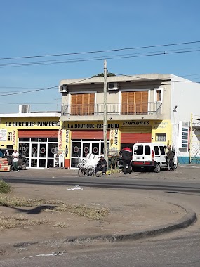
Bus station nearby Camino General Belgrano 2456
Argentina
Bus station nearby Camino General Belgrano 2456
Camino General Belgrano 2456
Berazategui Oeste, Buenos Aires Province, Argentina
contacts phone
:
+54
Latitude:
-34.7926126
, Longitude:
-58.2406321
larger map & directions
read more
nearest Bus station
262 m
Camino General Belgrano 2648
Argentina
Bus station
read more
272 m
Camino General Belgrano 2599-2649
Argentina
Bus station
read more
478 m
Calle 21 1002-1100
Argentina
Bus station
read more
524 m
Avenida Calchaquí 2550-2596
Argentina
Bus station
read more
547 m
Calle 21 1101-1199
Argentina
Bus station
read more
563 m
Avenida Calchaquí 2555-2587
Argentina
Bus station
read more
633 m
Camino General Belgrano 1900-2052
Argentina
Bus station
read more
680 m
Subteniente Juan Omar Abraham 2399-2599
Argentina
Bus station
read more
735 m
Camino General Belgrano 1800-1898
Argentina
Bus station
read more
757 m
Calle 21 1452-1500
Argentina
Bus station
read more
798 m
Avenida Calchaquí 2100-2148
Argentina
Bus station
read more
820 m
Avenida Calchaquí 2101-2149
Argentina
Bus station
read more
825 m
Subteniente Juan Omar Abraham 2400-2598
Argentina
Bus station
read more
854 m
Avenida Calchaquí 2823-2883
Argentina
Bus station
read more
864 m
Camino General Belgrano 3199-3299
Argentina
Bus station
read more
894 m
Avenida Calchaquí 2850-2892
Argentina
Bus station
read more
925 m
Avenida Teniente General Juan Domingo Perón 1799-1899
Argentina
Bus station
read more
960 m
Calle 21 1600-1698
Argentina
Bus station
read more
976 m
Avenida Eva Perón 1393
Argentina
Bus station
read more
1.047 km
Subteniente Juan Omar Abraham 2200-2298
Argentina
Bus station
read more
1.096 km
Camino General Belgrano 3429-3495
Argentina
Bus station
read more
1.147 km
Camino General Belgrano 3500-3548
Argentina
Bus station
read more
1.193 km
Avenida Dardo Rocha 2375
Argentina
Bus station
read more
1.27 km
Avenida Dardo Rocha 2099-2149
Argentina
Bus station
read more
1.336 km
Avenida Rigolleau 699-749
Argentina
Bus station
read more
📑
all categories
Accounting
Administrative area level 1
Administrative area level 2
Airport
Amusement park
Aquarium
Art gallery
Atm
Bakery
Bank
Bar
Beauty salon
Bicycle store
Book store
Bowling alley
Bus station
Cafe
Campground
Car dealer
Car rental
Car repair
Car wash
Casino
Cemetery
Church
City hall
Clothing store
Colloquial area
Convenience store
Country
Courthouse
Dentist
Department store
Doctor
Electrician
Electronics store
Embassy
Establishment
Finance
Fire station
Florist
Food
Funeral home
Furniture store
Gas station
General contractor
Grocery or supermarket
Gym
Hair care
Hardware store
Health
Hindu Temple
Home goods store
Hospital
Insurance agency
Intersection
Jewelry store
Laundry
Lawyer
Library
Light rail station
Liquor store
Local government office
Locality
Locksmith
Lodging
Meal delivery
Meal takeaway
Mosque
Movie rental
Movie theater
Moving company
Museum
Natural feature
Neighborhood
Night club
Painter
Park
Parking
Pet store
Pharmacy
Physiotherapist
Place of worship
Plumber
Point of interest
Police
Political
Post office
Premise
Real estate agency
Restaurant
Roofing contractor
Route
Rv park, camping
School
Shoe store
Shopping mall
Spa
Stadium
Storage
Store
Subpremise
Subway station
Supermarket
Synagogue
Taxi stand
Train station
Transit station
Travel agency
University
Veterinary care
Zoo
sublocality level 1
sublocality level 3
↑