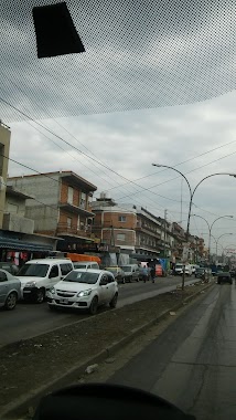
Bus station nearby Ojos de Salado 2499-2507
Argentina
Bus station nearby Ojos de Salado 2499-2507
Ojos de Salado 2499-2507
Villa Celina, Buenos Aires, Argentina
contacts phone
:
+54
Latitude:
-34.7029348
, Longitude:
-58.4930091
larger map & directions
read more
nearest Bus station
130 m
Martín Ugarte 1-99
Argentina
Bus station
read more
133 m
Calle Juárez Celman
Argentina
Bus station
read more
147 m
Avenida General San Martín 7750
Argentina
Bus station
read more
306 m
Unanue 346
Argentina
Bus station
read more
407 m
Martín Ugarte 749
Argentina
Bus station
read more
454 m
Avenida Strangford 1121
Argentina
Bus station
read more
477 m
Martín Ugarte 892
Argentina
Bus station
read more
646 m
Avenida Boulogne Sur Mer 1963
Argentina
Bus station
read more
650 m
De la Cooperacion 2-80
Argentina
Bus station
read more
767 m
Martiniano Chilavert 1102-1200
Argentina
Bus station
read more
794 m
Unanue 1047
Argentina
Bus station
read more
828 m
Soldado Juan Rava 1135A
Argentina
Bus station
read more
850 m
De la Huerta 211-249
Argentina
Bus station
read more
859 m
Avenida Boulogne Sur Mer 1701-1749
Argentina
Bus station
read more
875 m
Olavarría 2803
Argentina
Bus station
read more
911 m
Avenida Boulogne Sur Mer 1652-1700
Argentina
Bus station
read more
927 m
Del Prado 251-337
Argentina
Bus station
read more
970 m
Curapaligüe 1801-1857
Argentina
Bus station
read more
984 m
Del Valle 101-199
Argentina
Bus station
read more
1.016 km
Olavarría
Argentina
Bus station
read more
1.049 km
Avenida de Circunvalacion
Argentina
Bus station
read more
1.122 km
Avenida de Circunvalacion 2051-2703
Argentina
Bus station
read more
1.175 km
Soldado Juan Rava 1499-1529
Argentina
Bus station
read more
1.189 km
Soldado Juan Rava 1530-1598
Argentina
Bus station
read more
1.33 km
Soldado Juan Rava 1619-1699
Argentina
Bus station
read more
📑
all categories
Accounting
Administrative area level 1
Administrative area level 2
Airport
Amusement park
Aquarium
Art gallery
Atm
Bakery
Bank
Bar
Beauty salon
Bicycle store
Book store
Bowling alley
Bus station
Cafe
Campground
Car dealer
Car rental
Car repair
Car wash
Casino
Cemetery
Church
City hall
Clothing store
Colloquial area
Convenience store
Country
Courthouse
Dentist
Department store
Doctor
Electrician
Electronics store
Embassy
Establishment
Finance
Fire station
Florist
Food
Funeral home
Furniture store
Gas station
General contractor
Grocery or supermarket
Gym
Hair care
Hardware store
Health
Hindu Temple
Home goods store
Hospital
Insurance agency
Intersection
Jewelry store
Laundry
Lawyer
Library
Light rail station
Liquor store
Local government office
Locality
Locksmith
Lodging
Meal delivery
Meal takeaway
Mosque
Movie rental
Movie theater
Moving company
Museum
Natural feature
Neighborhood
Night club
Painter
Park
Parking
Pet store
Pharmacy
Physiotherapist
Place of worship
Plumber
Point of interest
Police
Political
Post office
Premise
Real estate agency
Restaurant
Roofing contractor
Route
Rv park, camping
School
Shoe store
Shopping mall
Spa
Stadium
Storage
Store
Subpremise
Subway station
Supermarket
Synagogue
Taxi stand
Train station
Transit station
Travel agency
University
Veterinary care
Zoo
sublocality level 1
sublocality level 3
↑