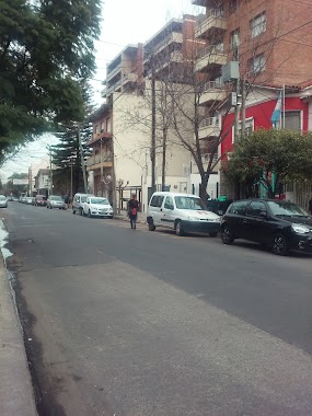
Bus station nearby Presidente Hipólito Yrigoyen 1979
Argentina
Bus station nearby Presidente Hipólito Yrigoyen 1979
Presidente Hipólito Yrigoyen 1979
Castelar, Buenos Aires, Argentina
contacts phone
:
+54
Latitude:
-34.6593269
, Longitude:
-58.6340046
larger map & directions
read more
nearest Bus station
358 m
Avenida Estanislao Zeballos 2202-2280
Argentina
Bus station
read more
362 m
Avenida del Libertador 730-798
Argentina
Bus station
read more
447 m
Presidente Hipólito Yrigoyen 1550-1590
Argentina
Bus station
read more
453 m
Fray Justo Santa María de Oro 1999-2099
Argentina
Bus station
read more
622 m
Gobernador Luis Monteverde 859
Argentina
Bus station
read more
711 m
Presidente Hipólito Yrigoyen 1277
Argentina
Bus station
read more
728 m
General Bartolomé Mitre 1731
Argentina
Bus station
read more
735 m
Fray Justo Santa María de Oro 1400-1498
Argentina
Bus station
read more
769 m
Fray Justo Santa María de Oro 2399-2551
Argentina
Bus station
read more
769 m
Presidente Hipólito Yrigoyen 1214-1280
Argentina
Bus station
read more
786 m
Humberto Primo 879
Argentina
Bus station
read more
787 m
General Bartolomé Mitre 2186
Argentina
Bus station
read more
852 m
Almafuerte 2514
Argentina
Bus station
read more
881 m
Fray Justo Santa María de Oro 1200-1298
Argentina
Bus station
read more
883 m
Avenida Eva Perón 1502-1526
Argentina
Bus station
read more
892 m
Humberto Primo 599-699
Argentina
Bus station
read more
898 m
Pola 200-300
Argentina
Bus station
read more
938 m
Martín Irigoyen 512
Argentina
Bus station
read more
986 m
Buenos Aires 699
Argentina
Bus station
read more
991 m
La Roche 479
Argentina
Bus station
read more
1.006 km
Avenida Figueroa Alcorta 506-598
Argentina
Bus station
read more
1.007 km
General Juan José Valle 405-499
Argentina
Bus station
read more
1.02 km
Pola 302-340
Argentina
Bus station
read more
1.079 km
General Juan José Valle 333-399
Argentina
Bus station
read more
1.216 km
Presidente Alessandri 399-499
Argentina
Bus station
read more
📑
all categories
Accounting
Administrative area level 1
Administrative area level 2
Airport
Amusement park
Aquarium
Art gallery
Atm
Bakery
Bank
Bar
Beauty salon
Bicycle store
Book store
Bowling alley
Bus station
Cafe
Campground
Car dealer
Car rental
Car repair
Car wash
Casino
Cemetery
Church
City hall
Clothing store
Colloquial area
Convenience store
Country
Courthouse
Dentist
Department store
Doctor
Electrician
Electronics store
Embassy
Establishment
Finance
Fire station
Florist
Food
Funeral home
Furniture store
Gas station
General contractor
Grocery or supermarket
Gym
Hair care
Hardware store
Health
Hindu Temple
Home goods store
Hospital
Insurance agency
Intersection
Jewelry store
Laundry
Lawyer
Library
Light rail station
Liquor store
Local government office
Locality
Locksmith
Lodging
Meal delivery
Meal takeaway
Mosque
Movie rental
Movie theater
Moving company
Museum
Natural feature
Neighborhood
Night club
Painter
Park
Parking
Pet store
Pharmacy
Physiotherapist
Place of worship
Plumber
Point of interest
Police
Political
Post office
Premise
Real estate agency
Restaurant
Roofing contractor
Route
Rv park, camping
School
Shoe store
Shopping mall
Spa
Stadium
Storage
Store
Subpremise
Subway station
Supermarket
Synagogue
Taxi stand
Train station
Transit station
Travel agency
University
Veterinary care
Zoo
sublocality level 1
sublocality level 3
↑