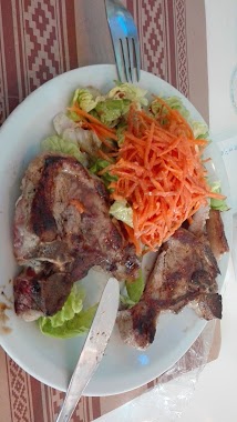
Cafe nearby Florinda
Argentina
Cafe nearby Florinda
Florinda
Mar del Plata, Buenos Aires, Argentina
contacts phone
:
+54
Latitude:
-38.0035172
, Longitude:
-57.5585861
larger map & directions
read more
nearest Cafe
199 m
Taguza
Mar del Plata
Cafe
read more
309 m
Matice
Mar del Plata
Cafe
read more
425 m
ARUBA
Alberti 2788, Primera Junta, Mar del Plata
Cafe
read more
514 m
Corner Café
San Luis 2607, Mar del Plata
Cafe
read more
539 m
La negrita
Bolívar 3014, Mar del Plata
Cafe
read more
597 m
Tizhianna
Avenida Colon 3597, Mar del Plata
Cafe
read more
599 m
Café Pirámide
Cordoba 2627 local 3 y 4, Mar del Plata
Cafe
read more
636 m
Valagu
Mar del Plata
Cafe
read more
638 m
Café Martínez
Avenida Colón 3651, Mar del Plata
Cafe
read more
761 m
Café Homero
Avenida Colón 2564, Mar del Plata
Cafe
read more
821 m
Coffee Zone Delivery
Catamarca 1815, Mar del Plata
Cafe
read more
829 m
Mateo resto
Santiago del Estero 2999, Mar del Plata
Cafe
read more
852 m
Falucho y la vía
B7600FSB, Falucho 3994, Mar del Plata
Cafe
read more
858 m
Bull cafe
Castelli 2427, Mar del Plata
Cafe
read more
869 m
Espacio Illy
Catamarca 1767, Mar del Plata
Cafe
read more
885 m
Fast & Funny
Belgrano 2692, Mar del Plata
Cafe
read more
972 m
Havanna
San Martín 2902, Mar del Plata
Cafe
read more
989 m
La Fonte D' Oro
Hipólito Irigoyen 1003 B7600GQL, Mar del Plata
Cafe
read more
989 m
La Terraza...desde 1963
Mar del Plata
Cafe
read more
1.003 km
Morena
Primera Junta 2899, Primera Junta, Mar del Plata
Cafe
read more
1.015 km
London
San Luis 1745, Mar del Plata
Cafe
read more
1.032 km
Havanna
Avenida Pedro Luro 3204, Mar del Plata
Cafe
read more
1.033 km
La Romana Café - Bar
Luro 3324 local 19, Mar del Plata
Cafe
read more
1.186 km
Cafe Rocket
25 de Mayo 2954, Mar del Plata
Cafe
read more
1.298 km
Pireu
Mar del Plata
Cafe
read more
📑
all categories
Accounting
Administrative area level 1
Administrative area level 2
Airport
Amusement park
Aquarium
Art gallery
Atm
Bakery
Bank
Bar
Beauty salon
Bicycle store
Book store
Bowling alley
Bus station
Cafe
Campground
Car dealer
Car rental
Car repair
Car wash
Casino
Cemetery
Church
City hall
Clothing store
Colloquial area
Convenience store
Country
Courthouse
Dentist
Department store
Doctor
Electrician
Electronics store
Embassy
Establishment
Finance
Fire station
Florist
Food
Funeral home
Furniture store
Gas station
General contractor
Grocery or supermarket
Gym
Hair care
Hardware store
Health
Hindu Temple
Home goods store
Hospital
Insurance agency
Intersection
Jewelry store
Laundry
Lawyer
Library
Light rail station
Liquor store
Local government office
Locality
Locksmith
Lodging
Meal delivery
Meal takeaway
Mosque
Movie rental
Movie theater
Moving company
Museum
Natural feature
Neighborhood
Night club
Painter
Park
Parking
Pet store
Pharmacy
Physiotherapist
Place of worship
Plumber
Point of interest
Police
Political
Post office
Premise
Real estate agency
Restaurant
Roofing contractor
Route
Rv park, camping
School
Shoe store
Shopping mall
Spa
Stadium
Storage
Store
Subpremise
Subway station
Supermarket
Synagogue
Taxi stand
Train station
Transit station
Travel agency
University
Veterinary care
Zoo
sublocality level 1
sublocality level 3
↑