Cafe nearby Panattieri
Argentina
Cafe nearby Panattieri
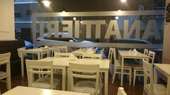
Panattieri
2630, Arenales, 1429, Comuna 2, Buenos Aires, AR Argentina
contacts phone
:
+54 11 2081-0348
website:
m.facebook.com
Latitude:
-34.592813
, Longitude:
-58.4036691
larger map & directions
read more
nearest Cafe
147 m
La Tolva
C1425BGO, Avenida Santa Fe 2602
Cafe
read more
149 m
Aroma Café
Avenida Santa Fe 2551
Cafe
read more
255 m
J.A.Roca
Charcas 2669
Cafe
read more
256 m
Pastelería El Progreso
Avenida Santa Fe 2820
Cafe
read more
270 m
Emilyn bakery & coffee
Charcas 2599
Cafe
read more
327 m
Bonafide
Beruti 2951
Cafe
read more
404 m
Café Martínez
Avenida Pueyrredón 1202
Cafe
read more
421 m
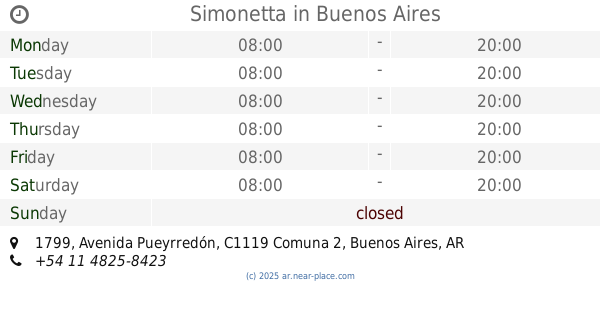
Simonetta
Avenida Pueyrredón 1799
Cafe
read more
423 m
Havanna
Avenida Pueyrredón 1802
Cafe
read more
510 m
Caren
Avenida Pueyrredón 1881
Cafe
read more
547 m
La Molinera
Avenida Santa Fe 2202
Cafe
read more
776 m
Starbucks
Avenida Santa Fe 1999
Cafe
read more
805 m
Delicity
Juncal 3100
Cafe
read more
808 m
Havanna
Av Córdoba 2370
Cafe
read more
838 m
Café Martínez
Arenales 1913
Cafe
read more
868 m
Olimpo Café Bar
Pasteur 791
Cafe
read more
892 m
Faricci Heladeria Av Pueyrredon
Avenida Pueyrredón 802
Cafe
read more
914 m
Café Estero
Viamonte 2602
Cafe
read more
975 m
Cafetería de Ciencias Económicas
Balvanera
Cafe
read more
995 m
Cachafaz Café
Uriburu 1789
Cafe
read more
1.004 km
Café Martínez
Bulnes 1790
Cafe
read more
1.055 km
El Club del Té | Academia de té, catas y eventos corporativos
AOA, José León Pagano 2653
Cafe
read more
1.13 km
Angelica
Riobamba 815
Cafe
read more
1.159 km
Cirse La Fábrica
Avenida Córdoba 3400
Cafe
read more
1.2 km
Heladeria Y Cafetería Palermo
Julián Álvarez 2492
Cafe
read more
📑
all categories
Accounting
Administrative area level 1
Administrative area level 2
Airport
Amusement park
Aquarium
Art gallery
Atm
Bakery
Bank
Bar
Beauty salon
Bicycle store
Book store
Bowling alley
Bus station
Cafe
Campground
Car dealer
Car rental
Car repair
Car wash
Casino
Cemetery
Church
City hall
Clothing store
Colloquial area
Convenience store
Country
Courthouse
Dentist
Department store
Doctor
Electrician
Electronics store
Embassy
Establishment
Finance
Fire station
Florist
Food
Funeral home
Furniture store
Gas station
General contractor
Grocery or supermarket
Gym
Hair care
Hardware store
Health
Hindu Temple
Home goods store
Hospital
Insurance agency
Intersection
Jewelry store
Laundry
Lawyer
Library
Light rail station
Liquor store
Local government office
Locality
Locksmith
Lodging
Meal delivery
Meal takeaway
Mosque
Movie rental
Movie theater
Moving company
Museum
Natural feature
Neighborhood
Night club
Painter
Park
Parking
Pet store
Pharmacy
Physiotherapist
Place of worship
Plumber
Point of interest
Police
Political
Post office
Premise
Real estate agency
Restaurant
Roofing contractor
Route
Rv park, camping
School
Shoe store
Shopping mall
Spa
Stadium
Storage
Store
Subpremise
Subway station
Supermarket
Synagogue
Taxi stand
Train station
Transit station
Travel agency
University
Veterinary care
Zoo
sublocality level 1
sublocality level 3
↑