Campground nearby Camping Smata Piletas
Argentina
Campground nearby Camping Smata Piletas
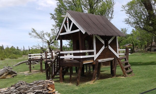
Camping Smata Piletas
Neuquén, Argentina
contacts phone
:
+54
Latitude:
-38.9949258
, Longitude:
-68.3393303
larger map & directions
read more
nearest Campground
5.554 km
Camping Viejo Este Senillosa
Senillosa Este, Río Limay, Neuquén
Campground
read more
6.317 km
Camping Viejo Senillosa
Senillosa
Campground
read more
8.255 km
Camping Plottier
Río Negro
Campground
read more
8.924 km
Camping Municipal Los Mimbres
Senillosa
Campground
read more
8.971 km
Camping Municipal Los Mimbres Senillosa
Neuquén
Campground
read more
10.432 km
camping los acantilados
Río Negro
Campground
read more
10.765 km
Camping ATE
Neuquen
Campground
read more
11.087 km
Camping Nepen Hue
Neuquén
Campground
read more
11.573 km
PREDIO ATE NEUQUEN (LEOPOLDO GONZALEZ)
Plottier
Campground
read more
11.589 km
Camping Nepen Hue
Río Limay, Neuquén
Campground
read more
12.867 km
trade center employees Camping Neuquen - Plottier
Plottier
Campground
read more
12.867 km
centro de empleados de comercio Camping Neuquen - plottier
Plottier
Campground
read more
13.409 km
Las Araucarias Camping
Neuquén
Campground
read more
14.079 km
Shushfitness
Ruta 22 Km 1231,5, Plottier
Campground
read more
14.12 km
Camping El Cisne
Ruta Nacional 22 Km. 1259, Senillosa
Campground
read more
14.464 km
Camping Costa Soleada
Balsa Las Perlas
Campground
read more
16.63 km
Campamento DD1 Unidades
Asunción, Neuquén
Campground
read more
18.458 km
Camping Perlas 1
Las Perlas
Campground
read more
18.783 km
Camping Mica Malen
Río Limay, Neuquén
Campground
read more
18.99 km
Camping Muten
Río Negro
Campground
read more
18.99 km
Camping Perlas 2
Las Perlas
Campground
read more
25.785 km
Camping Los Nonos
Neuquen
Campground
read more
26.814 km
El Estribo
Centenario
Campground
read more
27.696 km
Camping Los Alazanes
Neuquen
Campground
read more
28.899 km
Los Alzanes
Neuquén
Campground
read more
📑
all categories
Accounting
Administrative area level 1
Administrative area level 2
Airport
Amusement park
Aquarium
Art gallery
Atm
Bakery
Bank
Bar
Beauty salon
Bicycle store
Book store
Bowling alley
Bus station
Cafe
Campground
Car dealer
Car rental
Car repair
Car wash
Casino
Cemetery
Church
City hall
Clothing store
Colloquial area
Convenience store
Country
Courthouse
Dentist
Department store
Doctor
Electrician
Electronics store
Embassy
Establishment
Finance
Fire station
Florist
Food
Funeral home
Furniture store
Gas station
General contractor
Grocery or supermarket
Gym
Hair care
Hardware store
Health
Hindu Temple
Home goods store
Hospital
Insurance agency
Intersection
Jewelry store
Laundry
Lawyer
Library
Light rail station
Liquor store
Local government office
Locality
Locksmith
Lodging
Meal delivery
Meal takeaway
Mosque
Movie rental
Movie theater
Moving company
Museum
Natural feature
Neighborhood
Night club
Painter
Park
Parking
Pet store
Pharmacy
Physiotherapist
Place of worship
Plumber
Point of interest
Police
Political
Post office
Premise
Real estate agency
Restaurant
Roofing contractor
Route
Rv park, camping
School
Shoe store
Shopping mall
Spa
Stadium
Storage
Store
Subpremise
Subway station
Supermarket
Synagogue
Taxi stand
Train station
Transit station
Travel agency
University
Veterinary care
Zoo
sublocality level 1
sublocality level 3
↑