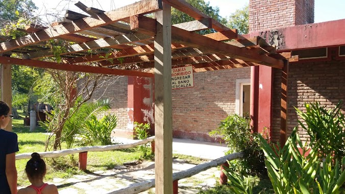
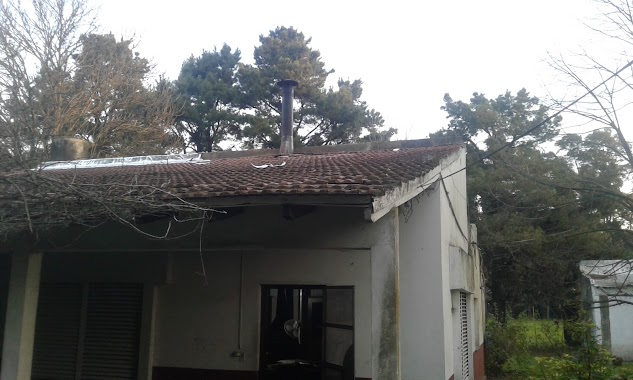
Campground nearby Recreo El Manantial
Argentina
Campground nearby Recreo El Manantial
Recreo El Manantial
Luján, Buenos Aires, Argentina
contacts phone
:
+54 2323 54-8598
Latitude:
-34.5579677
, Longitude:
-59.122903
larger map & directions
read more
nearest Campground
363 m
Recreo Lavalle Luján
Luján
Campground
read more
430 m
Recreo El Molino
Lezica y Torrezuri 857, Luján
Campground
read more
526 m
Salon Costa Lujan
Ruta 7 y, Rio Lujan, Luján
Campground
read more
535 m
Camping 7
Ruta Provincial 7, Luján
Campground
read more
538 m
Camping El Triángulo
Ruta Provincial 7, Luján
Campground
read more
563 m
Recreo Central Luján
Luján
Campground
read more
996 m
Recreo 04
Padre Salvaire 1278, Luján
Campground
read more
1.361 km
Recreo DON CESAR
Mariano Moreno, Luján
Campground
read more
2.227 km
Camping Cerveceros Sitecicsa
Luján
Campground
read more
3.667 km
Camping Biohuellas
Acceso Carlos Keen km 1, Luján
Campground
read more
4.107 km
RESERVA ECOTURÍSTICA BIOHUELLAS (30 personas o más)
Acceso a, Acceso Carlos Keen km 1, Luján
Campground
Park
Lodging
Point of interest
Establishment
read more
6.913 km
Aca - Luján Centro Recreativo
Luján
Campground
read more
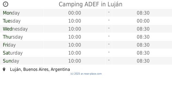
7.755 km
Camping ADEF
Luján
Campground
read more
15.401 km
Camping Truckers
Calle Di Marco, General Rodriguez
Campground
read more
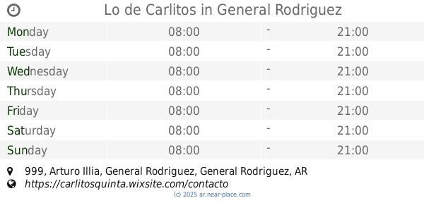
15.501 km
Lo de Carlitos
Arturo Illia 999, General Rodriguez
Campground
read more
15.554 km
Recreational Camping General Rodriguez
Calle Di Marco 400, General Rodríguez
Campground
Park
Lodging
Point of interest
Establishment
read more
15.554 km
Recreational Camping General Rodriguez
400, Calle Di Marco, General Rodriguez
Campground
read more
18.173 km
El Terraplén Granja educativa
Mar del Plata y Pigüé s/n, CP1748, General Rodríguez
Campground
Park
Lodging
Point of interest
Establishment
read more
18.205 km
Granja educativa El Terraplen
Mar del Plata y Pigüé s/n, General Rodriguez
Campground
read more
18.858 km
Campsic
499, B1633CRI, Yerbal 399, Fatima
Campground
read more
20.098 km
Farm Chocolatada
Ruta 8, Pilar
Campground
read more
20.866 km
Campo Recreativo Norte SUD
Exaltación de la Cruz
Campground
read more
24.221 km
camping el durazno
Unnamed Road, Marcos Paz
Campground
read more
25.016 km
Villa Rosa Central Park
Avenida Doctor Honorio Pueyrredón 1844, Villa Rosa
Campground
read more
27.41 km
Municipal Park Camping Los Robles
La Reja
Campground
read more
📑
all categories
Accounting
Administrative area level 1
Administrative area level 2
Airport
Amusement park
Aquarium
Art gallery
Atm
Bakery
Bank
Bar
Beauty salon
Bicycle store
Book store
Bowling alley
Bus station
Cafe
Campground
Car dealer
Car rental
Car repair
Car wash
Casino
Cemetery
Church
City hall
Clothing store
Colloquial area
Convenience store
Country
Courthouse
Dentist
Department store
Doctor
Electrician
Electronics store
Embassy
Establishment
Finance
Fire station
Florist
Food
Funeral home
Furniture store
Gas station
General contractor
Grocery or supermarket
Gym
Hair care
Hardware store
Health
Hindu Temple
Home goods store
Hospital
Insurance agency
Intersection
Jewelry store
Laundry
Lawyer
Library
Light rail station
Liquor store
Local government office
Locality
Locksmith
Lodging
Meal delivery
Meal takeaway
Mosque
Movie rental
Movie theater
Moving company
Museum
Natural feature
Neighborhood
Night club
Painter
Park
Parking
Pet store
Pharmacy
Physiotherapist
Place of worship
Plumber
Point of interest
Police
Political
Post office
Premise
Real estate agency
Restaurant
Roofing contractor
Route
Rv park, camping
School
Shoe store
Shopping mall
Spa
Stadium
Storage
Store
Subpremise
Subway station
Supermarket
Synagogue
Taxi stand
Train station
Transit station
Travel agency
University
Veterinary care
Zoo
sublocality level 1
sublocality level 3
↑