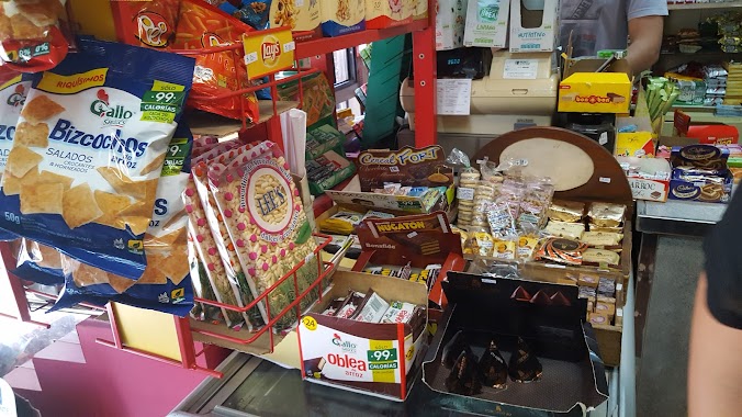
Convenience store nearby Maxikiosco del Roi
Argentina
Convenience store nearby Maxikiosco del Roi
Maxikiosco del Roi
317, Esmeralda, Comuna 1, Buenos Aires, AR Argentina
contacts phone
:
+54
website:
www.facebook.com
Latitude:
-34.604524
, Longitude:
-58.3779809
larger map & directions
read more
nearest Convenience store
128 m
Somos Nosotros - Golosinas
Avenida Presidente Roque Sáenz Peña 884
Convenience store
read more
469 m
Sbarra Maria
Galería Jardín, Florida 537
Convenience store
read more
487 m
Tu Kiosquito
Lavalle 1133
Convenience store
read more
494 m
Kiosco Gómez
Lavalle 1152
Convenience store
read more
517 m
Kiosco Rubén Gómez
Tte. General Juan Domingo Perón 1183
Convenience store
read more
532 m
Avenida
Avenida de Mayo 589
Convenience store
read more
580 m
Libertad 144
Libertad 144
Convenience store
read more
593 m
Centro Chacabuco SRL
Chacabuco 133
Convenience store
read more
595 m
El Porvenir
Avenida Corrientes 328
Convenience store
read more
599 m
Maxikiosco El Trago
Tucumán 452
Convenience store
read more
611 m
Store
Presidente Teniente General Juan Domingo Perón 317
Convenience store
read more
657 m
Kiosco Ulpiano
Lavalle 1281
Convenience store
read more
674 m
Maxikiosco del Sur
Adolfo Alsina 699
Convenience store
read more
692 m
KIOSCO “GUAZUVIRA
Avenida Leandro N. Alem 294, C1003AAF
Convenience store
read more
704 m
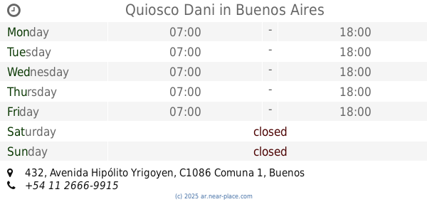
Quiosco Dani
Avenida Hipólito Yrigoyen 432
Convenience store
read more
750 m
Kiosco Sam
Esmeralda 899
Convenience store
read more
786 m
Kiosco Christen
Lavalle 1392
Convenience store
read more
789 m
MAXI SHOP
Paraguay 630
Convenience store
read more
794 m
Miga miga
Uruguay 348
Convenience store
read more
812 m
Los Rulos
Moreno 987
Convenience store
read more
903 m
What Osvaldo
Avenida Belgrano 701
Convenience store
read more
903 m
Lo de Osvaldo
Avenida Belgrano 701
Convenience store
read more
906 m
Lococo Bruno
San José 20
Convenience store
read more
923 m
Time Crazy
Paraná 430
Convenience store
read more
1.094 km
El Bodegón
Balcarce 400
Convenience store
read more
📑
all categories
Accounting
Administrative area level 1
Administrative area level 2
Airport
Amusement park
Aquarium
Art gallery
Atm
Bakery
Bank
Bar
Beauty salon
Bicycle store
Book store
Bowling alley
Bus station
Cafe
Campground
Car dealer
Car rental
Car repair
Car wash
Casino
Cemetery
Church
City hall
Clothing store
Colloquial area
Convenience store
Country
Courthouse
Dentist
Department store
Doctor
Electrician
Electronics store
Embassy
Establishment
Finance
Fire station
Florist
Food
Funeral home
Furniture store
Gas station
General contractor
Grocery or supermarket
Gym
Hair care
Hardware store
Health
Hindu Temple
Home goods store
Hospital
Insurance agency
Intersection
Jewelry store
Laundry
Lawyer
Library
Light rail station
Liquor store
Local government office
Locality
Locksmith
Lodging
Meal delivery
Meal takeaway
Mosque
Movie rental
Movie theater
Moving company
Museum
Natural feature
Neighborhood
Night club
Painter
Park
Parking
Pet store
Pharmacy
Physiotherapist
Place of worship
Plumber
Point of interest
Police
Political
Post office
Premise
Real estate agency
Restaurant
Roofing contractor
Route
Rv park, camping
School
Shoe store
Shopping mall
Spa
Stadium
Storage
Store
Subpremise
Subway station
Supermarket
Synagogue
Taxi stand
Train station
Transit station
Travel agency
University
Veterinary care
Zoo
sublocality level 1
sublocality level 3
↑