Gas station nearby Lubricar
Argentina
Gas station nearby Lubricar
Lubricar
1722, Avenida Pueyrredón, X5010, Córdoba, Capital, AR Argentina
contacts phone
:
+54 351 480-6480
Latitude:
-31.4208779
, Longitude:
-64.2105194
larger map & directions
read more
nearest Gas station
612 m
Borboroni Hermanos Srl
Córdoba
Gas station
read more
617 m
Bornoroni Hnos Srl
Hipólito Vieytes 987, Córdoba
Gas station
read more
657 m
YPF
Avenida Pueyrredón 2376, Córdoba
Gas station
read more
867 m
YPF
Avenida Santa Ana 2426, Córdoba
Gas station
read more
878 m
EG3 Gnc
Córdoba
Gas station
read more
878 m
Ypc Gnc
Córdoba
Gas station
read more
881 m
Gnc Mmag El Ala
Córdoba
Gas station
read more
887 m
YPF GNC
Avenida Santa Ana Av. Santa Ana, Córdoba
Gas station
read more
887 m
YPF - GNC - Av. Santa Ana
Avenida Santa Ana 2426, Córdoba
Gas station
read more
892 m
YPF
Av. Santa Ana 2426, Alto Alberdi, Córdoba
Gas station
read more
893 m
YPF
1398,X5000CQX, Julio A. Roca 1386, Córdoba
Gas station
read more
903 m
YPF
Julio A. Roca 1360, Villa maurizzi, Córdoba
Gas station
read more
988 m
YPF
Av. Duarte Quirós 1651, Alberdi, Córdoba
Gas station
read more
990 m
Estación de Servicio YPF
Duarte Quirós 1650-1698, Córdoba
Gas station
read more
1.097 km
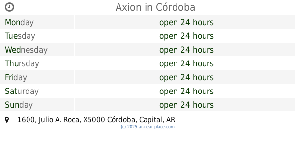
Axion
Julio A. Roca 1600, Córdoba
Gas station
read more
1.18 km
Esso Gnc
Córdoba
Gas station
read more
1.183 km
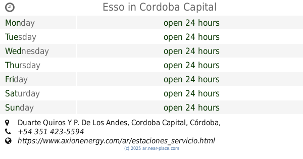
Esso
Duarte Quiros Y P. De Los Andes, Cordoba Capital
Gas station
read more
1.19 km
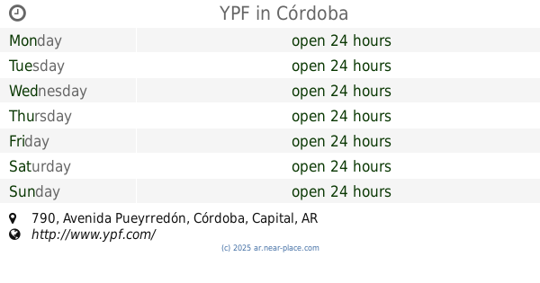
YPF
Avenida Pueyrredón 790, Córdoba
Gas station
read more
1.602 km
Lavadero De Autos
Avenida Pueyrredón 413-433, Córdoba
Gas station
read more
1.602 km
Car wash
Avenida Pueyrredón 413-433, Córdoba
Gas station
read more
1.965 km
YPF
Ruta Nacional 60 Km 822, Dean Funes
Gas station
read more
1.973 km
Estacion YPF Acuña
Córdoba
Gas station
read more
1.995 km
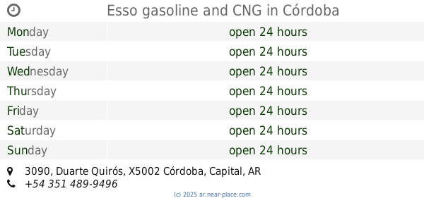
Esso gasoline and CNG
APO, APB, Duarte Quirós 3090, Córdoba
Gas station
read more
2.134 km
Esso
Av. Vélez Sarsfield 1732, Cáceres, Córdoba
Gas station
read more
2.366 km
Camionetanf
Avenida Castro Barros 8-64, Córdoba
Gas station
read more
📑
all categories
Accounting
Administrative area level 1
Administrative area level 2
Airport
Amusement park
Aquarium
Art gallery
Atm
Bakery
Bank
Bar
Beauty salon
Bicycle store
Book store
Bowling alley
Bus station
Cafe
Campground
Car dealer
Car rental
Car repair
Car wash
Casino
Cemetery
Church
City hall
Clothing store
Colloquial area
Convenience store
Country
Courthouse
Dentist
Department store
Doctor
Electrician
Electronics store
Embassy
Establishment
Finance
Fire station
Florist
Food
Funeral home
Furniture store
Gas station
General contractor
Grocery or supermarket
Gym
Hair care
Hardware store
Health
Hindu Temple
Home goods store
Hospital
Insurance agency
Intersection
Jewelry store
Laundry
Lawyer
Library
Light rail station
Liquor store
Local government office
Locality
Locksmith
Lodging
Meal delivery
Meal takeaway
Mosque
Movie rental
Movie theater
Moving company
Museum
Natural feature
Neighborhood
Night club
Painter
Park
Parking
Pet store
Pharmacy
Physiotherapist
Place of worship
Plumber
Point of interest
Police
Political
Post office
Premise
Real estate agency
Restaurant
Roofing contractor
Route
Rv park, camping
School
Shoe store
Shopping mall
Spa
Stadium
Storage
Store
Subpremise
Subway station
Supermarket
Synagogue
Taxi stand
Train station
Transit station
Travel agency
University
Veterinary care
Zoo
sublocality level 1
sublocality level 3
↑