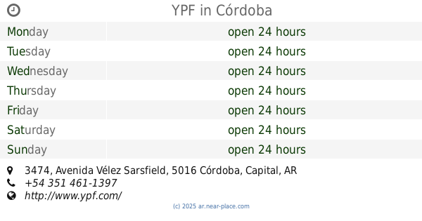
Gas station nearby YPF
Argentina
Gas station nearby YPF
YPF
Córdoba, Argentyna
contacts phone
:
+54
website:
ypf.com
Latitude:
-31.463194
, Longitude:
-64.1689086
larger map & directions
read more
nearest Gas station
515 m
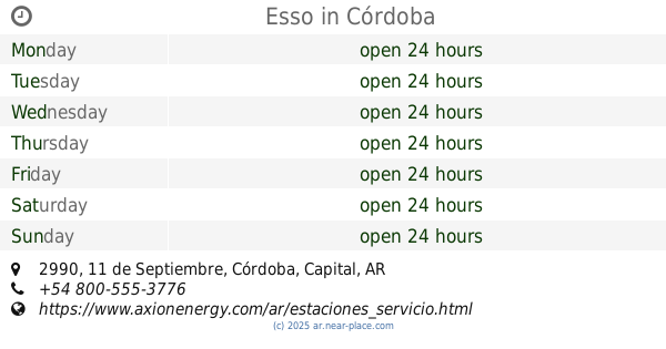
Esso
Av. O'Higgins Y Av. Richieri, Cordoba Capital
Gas station
read more
1.548 km
Gnc Acosta Gabriel Federico
Córdoba
Gas station
read more
1.705 km
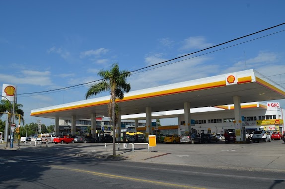
Shell
Avenida Ciudad de Valparaíso 4490, Jardin Hipodromo
Gas station
read more
1.705 km
Alfa Sur SRL
Avenida Ciudad de Valparaíso 4490, Córdoba
Gas station
read more
1.772 km
Petrobras
Av. Gral. O'Higgins 3026, Santa Rita, Córdoba
Gas station
read more
1.802 km
GNC Pavone O'Higgins
Jorge Ernesto Aguila 2951, Córdoba
Gas station
read more
1.866 km
Naftas y Gnc Bustos Diego Sebastián
Córdoba
Gas station
read more
2.011 km
GaSA
Cordoba
Gas station
read more
2.469 km
Esso
Avenida Pablo Ricchieri 2640, Córdoba
Gas station
read more
2.609 km
Esso
Huascha 2615, San Pablo, Córdoba
Gas station
read more
2.623 km
Esso
Huascha, Avenida Malagueño 2818, Córdoba
Gas station
read more
2.64 km
Esso
Avenida Malagueño 2818, Córdoba
Gas station
read more
2.699 km
Gnc Ypf
Córdoba
Gas station
read more
2.712 km
Esso
11 de Septiembre 5014, Córdoba
Gas station
read more
2.726 km
Esso
11 de Septiembre 2890, Córdoba
Gas station
read more
2.729 km
YPF
Avenida Ciudad de Valparaíso 2791, Córdoba
Gas station
read more
2.736 km
YPF
Av. Cd. de Valparaíso 2812, Ipona, Córdoba
Gas station
read more
2.747 km
Esso
11 de Septiembre 2990, Córdoba
Gas station
read more
2.747 km
Esso
Av 11 De Septiembre 2990 Barrio, Cordoba Capital
Gas station
read more
2.922 km
gomeria Hugo Brabo
Los Matacos 272, Córdoba
Gas station
read more
2.927 km
Gomeria Bravo Neumaticos
Avenida Madrid, Córdoba
Gas station
read more
2.954 km
YPF
Avenida Madrid Y Los Matacos, Córdoba
Gas station
read more
2.956 km
Petromadrid
Avenida Madrid 2394, Córdoba
Gas station
read more
3.298 km
Ypf Gnc
Córdoba
Gas station
read more
3.299 km
YPF
Avenida Vélez Sarsfield 3474, Córdoba
Gas station
read more
📑
all categories
Accounting
Administrative area level 1
Administrative area level 2
Airport
Amusement park
Aquarium
Art gallery
Atm
Bakery
Bank
Bar
Beauty salon
Bicycle store
Book store
Bowling alley
Bus station
Cafe
Campground
Car dealer
Car rental
Car repair
Car wash
Casino
Cemetery
Church
City hall
Clothing store
Colloquial area
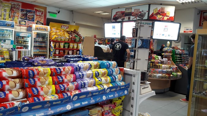
Convenience store
Country
Courthouse
Dentist
Department store
Doctor
Electrician
Electronics store
Embassy
Establishment
Finance
Fire station
Florist
Food
Funeral home
Furniture store
Gas station
General contractor
Grocery or supermarket
Gym
Hair care
Hardware store
Health
Hindu Temple
Home goods store
Hospital
Insurance agency
Intersection
Jewelry store
Laundry
Lawyer
Library
Light rail station
Liquor store
Local government office
Locality
Locksmith
Lodging
Meal delivery
Meal takeaway
Mosque
Movie rental
Movie theater
Moving company
Museum
Natural feature
Neighborhood
Night club
Painter
Park
Parking
Pet store
Pharmacy
Physiotherapist
Place of worship
Plumber
Point of interest
Police
Political
Post office
Premise
Real estate agency
Restaurant
Roofing contractor
Route
Rv park, camping
School
Shoe store
Shopping mall
Spa
Stadium
Storage
Store
Subpremise
Subway station
Supermarket
Synagogue
Taxi stand
Train station
Transit station
Travel agency
University
Veterinary care
Zoo
sublocality level 1
sublocality level 3
↑