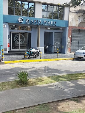
Health nearby Psicologa
Argentina
Health nearby Psicologa
Psicologa
1538, Saraza, C1424, Comuna 7, Buenos Aires, AR Argentina
contacts phone
:
+54 11 4921-5736
Latitude:
-34.6397303
, Longitude:
-58.4394585
larger map & directions
read more
nearest Health
391 m
KINESIOLOGO 49226747 KINESIOLOGIA A DOMICILIO
Santander 1409
Health
read more
421 m
Kinepro
Puan 1410
Health
read more
455 m
CeSAC Nº 19
Curapaligüe 1905
Health
read more
472 m
Lic. Andres Prado
Avenida Asamblea 1028
Health
read more
561 m
KINESIO
Avenida Asamblea 900, Buenos Aires
Health
read more
573 m
Acupuntura Prodigia
Argentina
Health
read more
582 m
송강한의원
C1406ICN, Balbastro 2040
Health
read more
633 m
Oftakame S.A.
Picheuta 1378
Health
read more
714 m
Asociacion Aikido Oeste Aikikai Argentina
953, CWK, Saraza C1424CWK, Buenos Aires
Health
read more
765 m
global kick boxing
Saraza 957
Health
read more
766 m
Asociacion Aikido Oeste Aikikai
953, CWK, Saraza C1424CWK, Buenos Aires
Health
read more
812 m
CeSAC N° 40
Avenida Coronel Esteban Bonorino 1729
Health
read more
917 m
Matarazzo, Azucena
Avenida Eva Perón 1711
Health
read more
964 m
Imaging Adrogué
Calle 6 120, Gran Buenos Aires
Health
read more
991 m
Clínica María Ward
Avenida Carabobo 1125
Health
read more
999 m
Lila Díaz D'Onofrio | Counseling
Baldomero Fernández Moreno 1239
Health
read more
1.001 km
Hogar BALDOMERO
Baldomero Fernández Moreno 1223
Health
read more
1.092 km
Academia BBG
Avenida Vernet 362
Health
read more
1.182 km
TOB ALTERNATIVA
Avenida Directorio 916
Health
read more
1.193 km
Monasterio
Curapaligüe 760
Health
read more
1.341 km
Meditación Argentina Centro de Flores
Avenida Carabobo 731, Buenos Aires
Health
read more
1.365 km
INSTITUTO GERIATRICO TIEMPO
C1424CME, Estrada 231
Health
read more
1.434 km
Laboratorios Alvear S.A.
Avenida General Francisco Fernández de la Cruz 1872
Health
read more
1.578 km
Omint
AAT, Avenida José María Moreno 638, Buenos Aires
Health
read more
1.972 km
Perfect Smile
Hortiguera 4
Health
read more
📑
all categories
Accounting
Administrative area level 1
Administrative area level 2
Airport
Amusement park
Aquarium
Art gallery
Atm
Bakery
Bank
Bar
Beauty salon
Bicycle store
Book store
Bowling alley
Bus station
Cafe
Campground
Car dealer
Car rental
Car repair
Car wash
Casino
Cemetery
Church
City hall
Clothing store
Colloquial area
Convenience store
Country
Courthouse
Dentist
Department store
Doctor
Electrician
Electronics store
Embassy
Establishment
Finance
Fire station
Florist
Food
Funeral home
Furniture store
Gas station
General contractor
Grocery or supermarket
Gym
Hair care
Hardware store
Health
Hindu Temple
Home goods store
Hospital
Insurance agency
Intersection
Jewelry store
Laundry
Lawyer
Library
Light rail station
Liquor store
Local government office
Locality
Locksmith
Lodging
Meal delivery
Meal takeaway
Mosque
Movie rental
Movie theater
Moving company
Museum
Natural feature
Neighborhood
Night club
Painter
Park
Parking
Pet store
Pharmacy
Physiotherapist
Place of worship
Plumber
Point of interest
Police
Political
Post office
Premise
Real estate agency
Restaurant
Roofing contractor
Route
Rv park, camping
School
Shoe store
Shopping mall
Spa
Stadium
Storage
Store
Subpremise
Subway station
Supermarket
Synagogue
Taxi stand
Train station
Transit station
Travel agency
University
Veterinary care
Zoo
sublocality level 1
sublocality level 3
↑