Hospital nearby Centro Médico Fernandez
Argentina
Hospital nearby Centro Médico Fernandez
Centro Médico Fernandez
2240, Uriarte, C1425, Comuna 14, Buenos Aires, AR Argentina
contacts phone
:
+54 11 4774-6500
website:
www.centromedico-f.com
Latitude:
-34.5828158
, Longitude:
-58.425639
larger map & directions
read more
nearest Hospital
174 m
Taller De Dibujo Cejota
C1425FOG, Fray Justo Santa María de Oro 2301-2329
Hospital
read more
261 m
Clinica
Tres Arroyos 2060
Hospital
read more
348 m
Argentina League Against Tuberculosis
Uriarte 2477
Hospital
read more
417 m
Los Arcos Sanatorium
Avenida Juan Bautista Justo 909
Hospital
read more
417 m
Sanatorio De Los Arcos
Avenida Juan Bautista Justo 909
Hospital
read more
481 m
Swiss Medical Center de los Arcos
Guatemala 5455, C1425BVE
Hospital
read more
481 m
Swiss Medical Center
Guatemala 5455
Hospital
read more
489 m
Hospital Italiano
Charcas 4999 C1425BOA
Hospital
read more
492 m
Clinica Dr Lantos
Humboldt 2355
Hospital
read more
494 m
Medico nueva zelanda
C1425FUE, Humboldt 2355
Hospital
read more
510 m
Instituto Medico
C1425FUC, Humboldt 2217
Hospital
read more
530 m
Cermed
C1425FUB, Humboldt 2200
Hospital
read more
588 m
Consultorio Flebología Dr.Ricardo Gruz
Malabia 2208
Hospital
read more
756 m
Instituto Furman
Avenida Raúl Scalabrini Ortíz 2033
Hospital
read more
800 m
Sanatorio San Lucas
Thames 1565
Hospital
read more
843 m
Sanatorio de La Trinidad Palermo
Avenida Cerviño 4720
Hospital
read more
880 m
Centro Medico Comunitario DIGNUS
2299, C1425DGG, Aráoz 2241
Hospital
read more
881 m
Instituto Sexológico Buenos Aires
C1425DGG, Aráoz 2287
Hospital
read more
891 m
ITRA Traumatología y Rehabilitación
Avenida Cerviño 4417
Hospital
read more
896 m
Centro Médico DIGNUS
Aráoz 2279
Hospital
read more
911 m
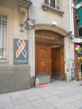
LALCEC
Aráoz 2380
Hospital
read more
927 m
Hospital
C1414DME, Malabia 1575
Hospital
read more
1.02 km
OCMI
Sinclair 3106
Hospital
read more
1.103 km
Mariana Matelli
Avenida Medrano 1970
Hospital
read more
1.362 km
Centro Medico Racais
3607, Paraguay
Hospital
read more
📑
all categories
Accounting
Administrative area level 1
Administrative area level 2
Airport
Amusement park
Aquarium
Art gallery
Atm
Bakery
Bank
Bar
Beauty salon
Bicycle store
Book store
Bowling alley
Bus station
Cafe
Campground
Car dealer
Car rental
Car repair
Car wash
Casino
Cemetery
Church
City hall
Clothing store
Colloquial area
Convenience store
Country
Courthouse
Dentist
Department store
Doctor
Electrician
Electronics store
Embassy
Establishment
Finance
Fire station
Florist
Food
Funeral home
Furniture store
Gas station
General contractor
Grocery or supermarket
Gym
Hair care
Hardware store
Health
Hindu Temple
Home goods store
Hospital
Insurance agency
Intersection
Jewelry store
Laundry
Lawyer
Library
Light rail station
Liquor store
Local government office
Locality
Locksmith
Lodging
Meal delivery
Meal takeaway
Mosque
Movie rental
Movie theater
Moving company
Museum
Natural feature
Neighborhood
Night club
Painter
Park
Parking
Pet store
Pharmacy
Physiotherapist
Place of worship
Plumber
Point of interest
Police
Political
Post office
Premise
Real estate agency
Restaurant
Roofing contractor
Route
Rv park, camping
School
Shoe store
Shopping mall
Spa
Stadium
Storage
Store
Subpremise
Subway station
Supermarket
Synagogue
Taxi stand
Train station
Transit station
Travel agency
University
Veterinary care
Zoo
sublocality level 1
sublocality level 3
↑