Hospital nearby Medico Anima
Argentina
Hospital nearby Medico Anima
Medico Anima
3277, Tinogasta, C1417, Comuna 11, Buenos Aires, AR Argentina
contacts phone
:
+54
Latitude:
-34.6011255
, Longitude:
-58.4968749
larger map & directions
read more
nearest Hospital
75 m
Medicos
Campana 3255
Hospital
read more
83 m
Majestic Medical Center
Campana 3256
Hospital
read more
84 m
Signa Imágenes Médicas
Tinogasta 3218
Hospital
read more
342 m
Anto In Wonderland
Pedro Lozano 3047, Pedro Lozano 3047
Hospital
read more
380 m
Oftalmologia
C1417CRG, Helguera 3399
Hospital
read more
553 m
Hospital Roffo
Avenida San Martín 5316
Hospital
read more
557 m
omar
Avenida San Martín 5481 C1417DTB
Hospital
read more
557 m
Hospital Rofo
Avenida San Martín 5481
Hospital
read more
575 m
María de Los Angeles
Cuenca 3658
Hospital
read more
591 m
Institute of Oncology Angel H. Roffo
Avenida San Martín 5481
Hospital
read more
591 m
Instituto de Oncología Ángel H. Roffo
Avenida San Martín 5481
Hospital
read more
603 m
URUBA
Avenida San Martín 5481
Hospital
read more
624 m
Consultorio Clau Felix
C1417AOT, San Nicolás 3050
Hospital
read more
717 m
Italian Villa Del Parque
Cuenca 2586
Hospital
read more
724 m
clinica devoto santoro 3393 pb moran
Pedro Morán 3380-3400
Hospital
read more
752 m
Hospital Italiano
Cuenca 2590
Hospital
read more
778 m
Centro Medico Helguera
Helguera 2578
Hospital
read more
793 m
Buenos Aires
Villa Devoto
Hospital
read more
952 m
Sirio Libanes
C1417ASW, Bahía Blanca 3267-3299
Hospital
read more
989 m
Centro Privado de Medicina Familiar
José Pedro Varela 3954, -, José Pedro Varela 3901 (Anexo)
Hospital
read more
1.002 km
Clinica Del Parque
Terrada 2745
Hospital
read more
1.006 km
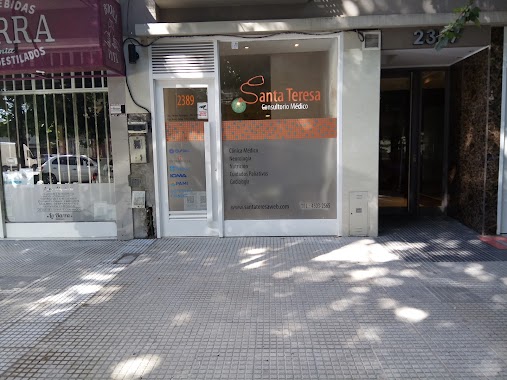
Santa Teresa Consultorios Médicos
Cuenca 2389
Hospital
read more
1.042 km
Zubizarrets
Helguera 4079-4099
Hospital
read more
1.223 km
Centro Médico Devoto Galeno A.R.T.
Avenida San Martín 6502
Hospital
read more
1.558 km
Hospital Sirio Libanes
Campana 4658
Hospital
read more
📑
all categories
Accounting
Administrative area level 1
Administrative area level 2
Airport
Amusement park
Aquarium
Art gallery
Atm
Bakery
Bank
Bar
Beauty salon
Bicycle store
Book store
Bowling alley
Bus station
Cafe
Campground
Car dealer
Car rental
Car repair
Car wash
Casino
Cemetery
Church
City hall
Clothing store
Colloquial area
Convenience store
Country
Courthouse
Dentist
Department store
Doctor
Electrician
Electronics store
Embassy
Establishment
Finance
Fire station
Florist
Food
Funeral home
Furniture store
Gas station
General contractor
Grocery or supermarket
Gym
Hair care
Hardware store
Health
Hindu Temple
Home goods store
Hospital
Insurance agency
Intersection
Jewelry store
Laundry
Lawyer
Library
Light rail station
Liquor store
Local government office
Locality
Locksmith
Lodging
Meal delivery
Meal takeaway
Mosque
Movie rental
Movie theater
Moving company
Museum
Natural feature
Neighborhood
Night club
Painter
Park
Parking
Pet store
Pharmacy
Physiotherapist
Place of worship
Plumber
Point of interest
Police
Political
Post office
Premise
Real estate agency
Restaurant
Roofing contractor
Route
Rv park, camping
School
Shoe store
Shopping mall
Spa
Stadium
Storage
Store
Subpremise
Subway station
Supermarket
Synagogue
Taxi stand
Train station
Transit station
Travel agency
University
Veterinary care
Zoo
sublocality level 1
sublocality level 3
↑