Lodging nearby Via Viel Buenos Aires
Argentina
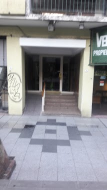
Lodging nearby Via Viel Buenos Aires
Via Viel Buenos Aires
928, Viel, C1424, Comuna 7, Buenos Aires, AR Argentina
contacts phone
:
+54 11 5098-8401
Latitude:
-34.6279841
, Longitude:
-58.4307616
larger map & directions
read more
nearest Lodging
327 m
Hotel los Amigos
Viel 1187
Lodging
read more
393 m
Pedro Goyena Residencia
Avenida Pedro Goyena 40
Lodging
read more
453 m
HOTEL CARRASCO
Avenida Pedro Goyena 531
Lodging
read more
504 m
Hospedaje Margust
Beauchef 577
Lodging
read more
599 m
Hospedaje Caballito
C1424AHP, San José de Calasanz 752
Lodging
read more
629 m
Casa Papa
C1424AHM, San José de Calasanz 665, Buenos Aires
Lodging
read more
691 m
Depar Arquitectonico
Estados Unidos 4263
Lodging
read more
698 m
Hotel Suite
Lodging
read more
726 m
hotel ospepri
1579 C1250AAF, Avenida La Plata 1541
Lodging
read more
794 m
Hotel LIBERTADOR
Formosa 253
Lodging
read more
866 m
Bright new large studio 3 blocks to subway station
511 Formosa 8° piso C, Buenos Aires
Lodging
read more
889 m
Luz de vida
C1424BOH, Senillosa 346
Lodging
read more
891 m
La Marea Hostal
EE Unidos 4070, Capital Federal, Capital Federal
Lodging
read more
911 m
Hotel Aoma
Estados Unidos 4049
Lodging
read more
919 m
Caballito 3
Thompson 449
Lodging
read more
931 m
Hotel Osam
Estados Unidos 4037
Lodging
read more
974 m
Amiboedo
Castro 1157, Buenos Aires
Lodging
read more
980 m
Hualfin 853
Hualfin 853
Lodging
read more
985 m
Luna Madre Hostel
Hualfin 864
Lodging
read more
1.076 km
Hotel Europa
Emilio Mitre 1294
Lodging
read more
1.152 km
Tequila Remis
Rosario 762
Lodging
read more
1.365 km
Grants
Yerbal 744
Lodging
read more
1.376 km
Agrelo
Castro 614
Lodging
read more
1.377 km
Albergue Transitorio
Yerbal 744, C1405CDP
Lodging
read more
1.38 km
Hotel Grant's
Yerbal 740
Lodging
read more
📑
all categories
Accounting
Administrative area level 1
Administrative area level 2
Airport
Amusement park
Aquarium
Art gallery
Atm
Bakery
Bank
Bar
Beauty salon
Bicycle store
Book store
Bowling alley
Bus station
Cafe
Campground
Car dealer
Car rental
Car repair
Car wash
Casino
Cemetery
Church
City hall
Clothing store
Colloquial area
Convenience store
Country
Courthouse
Dentist
Department store
Doctor
Electrician
Electronics store
Embassy
Establishment
Finance
Fire station
Florist
Food
Funeral home
Furniture store
Gas station
General contractor
Grocery or supermarket
Gym
Hair care
Hardware store
Health
Hindu Temple
Home goods store
Hospital
Insurance agency
Intersection
Jewelry store
Laundry
Lawyer
Library
Light rail station
Liquor store
Local government office
Locality
Locksmith
Lodging
Meal delivery
Meal takeaway
Mosque
Movie rental
Movie theater
Moving company
Museum
Natural feature
Neighborhood
Night club
Painter
Park
Parking
Pet store
Pharmacy
Physiotherapist
Place of worship
Plumber
Point of interest
Police
Political
Post office
Premise
Real estate agency
Restaurant
Roofing contractor
Route
Rv park, camping
School
Shoe store
Shopping mall
Spa
Stadium
Storage
Store
Subpremise
Subway station
Supermarket
Synagogue
Taxi stand
Train station
Transit station
Travel agency
University
Veterinary care
Zoo
sublocality level 1
sublocality level 3
↑