Night club nearby Esfera Artes
Argentina
Night club nearby Esfera Artes
Esfera Artes
287, Talcahuano, C1013, Comuna 1, Buenos Aires, AR Argentina
contacts phone
:
+54 11 4381-6306
website:
esferadata.wix.com
Latitude:
-34.6054507
, Longitude:
-58.3849429
larger map & directions
read more
nearest Night club
50 m
Pv Talca
Talcahuano 308, Buenos Aires
Night club
read more
141 m
Meganight Fest
Presidente Teniente General Juan Domingo Perón 1372
Night club
read more
188 m
Discoteca Bar Amigo
Night club
read more
438 m
Renzo Fc
Avenida 9 de Julio, Buenos Aires
Night club
read more
473 m
Mystique
Sarmiento 1662, 1042 Buenos Aires
Night club
read more
574 m
WAX Buenos Aires
C1042ABH, ABH, Sarmiento 1728, Buenos Aires
Night club
read more
579 m
WAX V.I.P
Sarmiento 1727
Night club
read more
597 m
AndroPenis
Presidente Luis Sáenz Peña 127, Plaza Congreso
Night club
read more
598 m
HUANG HE - VIGOR VIRIL
Presidente Luis Sáenz Peña 127, Congreso
Night club
read more
604 m
Puerto Rico
C1042ABH, Sarmiento 1750, Buenos Aires
Night club
read more
643 m
Cocoliche
C1002AAT, Avenida Rivadavia 878
Night club
read more
734 m
Vespasiani Automotores Sa
Night club
read more
735 m
bardo ex mocoro
Avenida Hipólito Yrigoyen 851
Night club
read more
749 m
Sala De Ensayo Aurora Lubiz
C1041AAP, Sarmiento 722
Night club
read more
751 m
Club One
C1088AAB, Adolfo Alsina 940, Buenos Aires
Night club
read more
888 m
Jzjdb
Florida 250
Night club
read more
914 m
Tota
córdoba 1752, C1055AAU
Night club
read more
915 m
BREAK TNGRS
C1033AAW, Avenida Rivadavia 1906
Night club
read more
917 m
Fiesta La Warhol
C1033AAW, Avenida Rivadavia 1910
Night club
read more
918 m
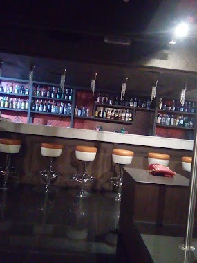
La Rumba de los Martes
Avenida Corrientes 1975
Night club
read more
1.012 km
Catto's
Suipacha 930
Night club
read more
1.149 km
Mitre Y Florida
Florida 844
Night club
read more
1.205 km
La Warhol
Avenida Córdoba 543
Night club
read more
1.218 km
The Sub
Avenida Córdoba 543
Night club
read more
1.332 km
Club MUSEUM Bs As
Perú 535, C1068AAA, Buenos Aires
Night club
read more
📑
all categories
Accounting
Administrative area level 1
Administrative area level 2
Airport
Amusement park
Aquarium
Art gallery
Atm
Bakery
Bank
Bar
Beauty salon
Bicycle store
Book store
Bowling alley
Bus station
Cafe
Campground
Car dealer
Car rental
Car repair
Car wash
Casino
Cemetery
Church
City hall
Clothing store
Colloquial area
Convenience store
Country
Courthouse
Dentist
Department store
Doctor
Electrician
Electronics store
Embassy
Establishment
Finance
Fire station
Florist
Food
Funeral home
Furniture store
Gas station
General contractor
Grocery or supermarket
Gym
Hair care
Hardware store
Health
Hindu Temple
Home goods store
Hospital
Insurance agency
Intersection
Jewelry store
Laundry
Lawyer
Library
Light rail station
Liquor store
Local government office
Locality
Locksmith
Lodging
Meal delivery
Meal takeaway
Mosque
Movie rental
Movie theater
Moving company
Museum
Natural feature
Neighborhood
Night club
Painter
Park
Parking
Pet store
Pharmacy
Physiotherapist
Place of worship
Plumber
Point of interest
Police
Political
Post office
Premise
Real estate agency
Restaurant
Roofing contractor
Route
Rv park, camping
School
Shoe store
Shopping mall
Spa
Stadium
Storage
Store
Subpremise
Subway station
Supermarket
Synagogue
Taxi stand
Train station
Transit station
Travel agency
University
Veterinary care
Zoo
sublocality level 1
sublocality level 3
↑