Night club nearby La Bicicleta Tango Club
Argentina
Night club nearby La Bicicleta Tango Club
La Bicicleta Tango Club
2963, Avenida Federico Lacroze, C1426, Comuna 13, Buenos Aires, AR Argentina
contacts phone
:
+54
website:
facebook.com
Latitude:
-34.575441
, Longitude:
-58.448116
larger map & directions
read more
nearest Night club
181 m
Teodoro Garcia 3500
Teodoro García 3500
Night club
read more
211 m
Palais Lacroix
Avenida Federico Lacroze 3106, C1426CQR
Night club
read more
365 m
Sofia
Amenábar 733
Night club
read more
611 m
Padel La Normanda
C1426BDL, Delgado 860
Night club
read more
650 m
Kiosco
Delgado 301-399, C1426BDA
Night club
read more
689 m
Palacete de cabildo 🕌
Avenida Cabildo 526 C1426AAS
Night club
read more
766 m
Peugeot Siro Sa
Avenida Álvarez Thomas 931
Night club
read more
778 m
Parada Del 57 Matienzo
Avenida Cabildo, C1426AAQ
Night club
read more
819 m
Sala Alvarez Thomas
C1427CCW, Avenida Álvarez Thomas 992
Night club
read more
820 m
Finka
Gorostiaga 2329, C1426CTQ
Night club
read more
822 m
Fridha
C1414CKM, Avenida Dorrego 1735, Buenos Aires
Night club
read more
825 m
Voodoo
Avenida Dorrego 1735
Night club
read more
893 m
Gier Music Club
Avenida Álvarez Thomas 1078
Night club
read more
928 m
Doso
Avenida Álvarez Thomas 1121
Night club
read more
928 m
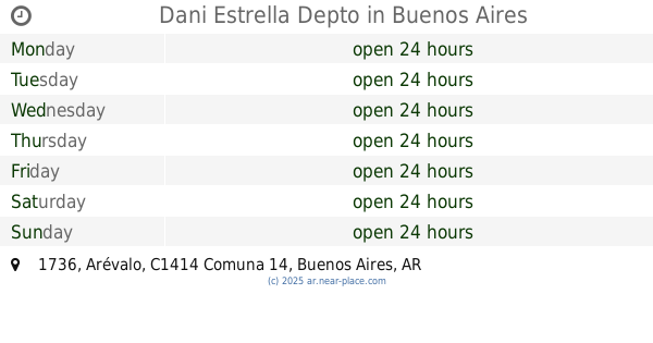
Dani Estrella Depto
Arévalo 1736, Buenos Aires
Night club
read more
928 m
chau papusa
Avenida Álvarez Thomas 1121
Night club
read more
933 m
Shika Tattoo
Night club
read more
1.014 km
Humedales
Capitán General Ramón Freire 1541
Night club
read more
1.041 km
El Alma Bar (oficial)
1414, Honduras 5916
Night club
read more
1.055 km
Newbery Palermo
Dr E Ravignani 1707
Night club
read more
1.091 km
Lo De Daro
C1414BFK, Avenida Coronel Niceto Vega 5941
Night club
read more
1.224 km
Green
Zabala 3829, C1427DYG
Night club
read more
1.243 km
Mi Tierra
Honduras 5750
Night club
read more
1.294 km
Teatro Avila
C1414CMT, Bonpland 1660
Night club
read more
1.573 km
Cantobar Palermo
Humboldt & El Salvador
Night club
read more
📑
all categories
Accounting
Administrative area level 1
Administrative area level 2
Airport
Amusement park
Aquarium
Art gallery
Atm
Bakery
Bank
Bar
Beauty salon
Bicycle store
Book store
Bowling alley
Bus station
Cafe
Campground
Car dealer
Car rental
Car repair
Car wash
Casino
Cemetery
Church
City hall
Clothing store
Colloquial area
Convenience store
Country
Courthouse
Dentist
Department store
Doctor
Electrician
Electronics store
Embassy
Establishment
Finance
Fire station
Florist
Food
Funeral home
Furniture store
Gas station
General contractor
Grocery or supermarket
Gym
Hair care
Hardware store
Health
Hindu Temple
Home goods store
Hospital
Insurance agency
Intersection
Jewelry store
Laundry
Lawyer
Library
Light rail station
Liquor store
Local government office
Locality
Locksmith
Lodging
Meal delivery
Meal takeaway
Mosque
Movie rental
Movie theater
Moving company
Museum
Natural feature
Neighborhood
Night club
Painter
Park
Parking
Pet store
Pharmacy
Physiotherapist
Place of worship
Plumber
Point of interest
Police
Political
Post office
Premise
Real estate agency
Restaurant
Roofing contractor
Route
Rv park, camping
School
Shoe store
Shopping mall
Spa
Stadium
Storage
Store
Subpremise
Subway station
Supermarket
Synagogue
Taxi stand
Train station
Transit station
Travel agency
University
Veterinary care
Zoo
sublocality level 1
sublocality level 3
↑