Park nearby BAIRESGROW
Argentina
Park nearby BAIRESGROW
BAIRESGROW
1517, Azopardo, C1107, Comuna 4, Buenos Aires, AR Argentina
contacts phone
:
+54 9 11 3896-8611
Latitude:
-34.625357
, Longitude:
-58.3666195
larger map & directions
read more
nearest Park
300 m
Parque Lezama
Avenida Brasil
Park
read more
329 m
Plaza Maestro Quinquela
Arnaldo D Esposito 101
Park
read more
450 m
Plaza Escuela Emigrantes
Enrique Gustavino 401-451, C1156AEC
Park
read more
578 m
Placita Lucila
500,C1156AAJ, Doctor Eduardo Braun Menéndez 402
Park
read more
580 m
Plaza Malvinas Islands
Park
read more
715 m
Plaza Dorrego
C1103 Buenos Aires, Argentina
Park
read more
715 m
Plaza Dorrego
Park
read more
773 m
Flora Nativa Benito Quinquela Martín Park
Irala
Park
read more
841 m
Plazoleta Cecilia Grierson
Avenida San Juan 679
Park
read more
841 m
Cecilia Grierson Plazoleta
Avenida San Juan 679
Park
read more
890 m
Plazoleta Eva Perón
826, C1063, Avenida Paseo Colón 802
Park
read more
903 m
Plazoleta Vera Peñaloza
Chacabuco 1208
Park
read more
903 m
Plaza Irala
C1163ABL, Irala 502-600
Park
read more
903 m
Vera Peñaloza Plazoleta
Chacabuco 1208
Park
read more
925 m
Plazoleta Ing. Cesar M Polledo
Avenida Paseo Colón 823, Buenos Aires
Park
read more
942 m
Plaza Rosario Vera Peñaloza
Park
read more
953 m
Parque Madero
Puerto Madero
Park
read more
1.035 km
Eva Duarte de Perón Park
Julieta Lanteri 1775
Park
read more
1.038 km
Plaza de la Usina
Park
read more
1.058 km
Parque Bonito
Julieta Lanteri 1740
Park
read more
1.138 km
Plazoleta de los Molfetteses
Salida 341
Park
read more
1.156 km
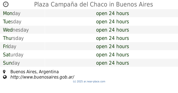
Plaza Campaña del Chaco
Park
read more
1.272 km
Haroldo Conti
Park
read more
1.338 km
Ingreso Brasil - Reserva Ecológica Costanera Sur
Camino de los Plumerillos
Park
read more
1.382 km
Paseo Guardavidas Argentinos
Park
read more
📑
all categories
Accounting
Administrative area level 1
Administrative area level 2
Airport
Amusement park
Aquarium
Art gallery
Atm
Bakery
Bank
Bar
Beauty salon
Bicycle store
Book store
Bowling alley
Bus station
Cafe
Campground
Car dealer
Car rental
Car repair
Car wash
Casino
Cemetery
Church
City hall
Clothing store
Colloquial area
Convenience store
Country
Courthouse
Dentist
Department store
Doctor
Electrician
Electronics store
Embassy
Establishment
Finance
Fire station
Florist
Food
Funeral home
Furniture store
Gas station
General contractor
Grocery or supermarket
Gym
Hair care
Hardware store
Health
Hindu Temple
Home goods store
Hospital
Insurance agency
Intersection
Jewelry store
Laundry
Lawyer
Library
Light rail station
Liquor store
Local government office
Locality
Locksmith
Lodging
Meal delivery
Meal takeaway
Mosque
Movie rental
Movie theater
Moving company
Museum
Natural feature
Neighborhood
Night club
Painter
Park
Parking
Pet store
Pharmacy
Physiotherapist
Place of worship
Plumber
Point of interest
Police
Political
Post office
Premise
Real estate agency
Restaurant
Roofing contractor
Route
Rv park, camping
School
Shoe store
Shopping mall
Spa
Stadium
Storage
Store
Subpremise
Subway station
Supermarket
Synagogue
Taxi stand
Train station
Transit station
Travel agency
University
Veterinary care
Zoo
sublocality level 1
sublocality level 3
↑