Park nearby Espacio Verde Galpón
Argentina
Park nearby Espacio Verde Galpón
Espacio Verde Galpón
contacts phone
:
+54
Latitude:
-34.5844372
, Longitude:
-58.3794794
read more
nearest Park
661 m
Sta. Francisca J. Cabrini
Cabo Pablo T. Fels 312-400
Park
read more
673 m
Plaza Isidoro Ruiz Moreno
Cerrito 1501-1525
Park
read more
701 m
Parque Carlos Thays
Park
read more
701 m
Carlos Thays Park
Park
read more
713 m
Plaza Soldi
1100,, Posadas 1078
Park
read more
753 m
Plaza Cnel. Toribio Tedín
C1011, Autopista Presidente Arturo Umberto Illia 80
Park
read more
793 m
Plaza Israeli Embassy
Arroyo 888
Park
read more
820 m
Plaza de Cataluña
Avenida del Libertador 550
Park
read more
869 m
Plaza Carlos Pellegrini
Avenida Alvear 1350
Park
read more
885 m
Plaza Pierre de Coubertin
Avenida del Libertador 550
Park
read more
897 m
Plaza Ing. Carlos M. Della Paolera
Park
read more
906 m
Plaza Canadá
Ramos Mejía y Antártida Argentina
Park
read more
920 m
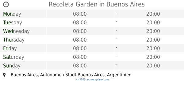
Recoleta Garden
Park
read more
920 m
Jardín de la Recoleta
Park
read more
933 m
Plazoleta Carlos Della Paolera
Carlos Pellegrini 1302-1334
Park
read more
940 m
Plaza Palais de Glace
Buenos Aires
Park
read more
942 m
Plazoleta Brig. Gral. Tomás de Iriarte
Park
read more
945 m
Fundación Make
Avenida Alvear 1981
Park
read more
952 m
Plaza Julio de Caro
Avenida del Libertador 1201-1255, C1112ABC
Park
read more
959 m
Plaza San Martín de Tours
Avenida Alvear 2136
Park
read more
1.002 km
Plaza Argentina Air Force
Park
read more
1.002 km
Plaza Fuerza Aérea Argentina
Park
read more
1.003 km
Solarium Plaza Francia
Park
read more
1.14 km
Plazoleta Pedro M. Obligado
Avenida del Libertador 550
Park
read more
1.275 km
Plazoleta Blas Parera
Montevideo 1484
Park
read more
📑
all categories
Accounting
Administrative area level 1
Administrative area level 2
Airport
Amusement park
Aquarium
Art gallery
Atm
Bakery
Bank
Bar
Beauty salon
Bicycle store
Book store
Bowling alley
Bus station
Cafe
Campground
Car dealer
Car rental
Car repair
Car wash
Casino
Cemetery
Church
City hall
Clothing store
Colloquial area
Convenience store
Country
Courthouse
Dentist
Department store
Doctor
Electrician
Electronics store
Embassy
Establishment
Finance
Fire station
Florist
Food
Funeral home
Furniture store
Gas station
General contractor
Grocery or supermarket
Gym
Hair care
Hardware store
Health
Hindu Temple
Home goods store
Hospital
Insurance agency
Intersection
Jewelry store
Laundry
Lawyer
Library
Light rail station
Liquor store
Local government office
Locality
Locksmith
Lodging
Meal delivery
Meal takeaway
Mosque
Movie rental
Movie theater
Moving company
Museum
Natural feature
Neighborhood
Night club
Painter
Park
Parking
Pet store
Pharmacy
Physiotherapist
Place of worship
Plumber
Point of interest
Police
Political
Post office
Premise
Real estate agency
Restaurant
Roofing contractor
Route
Rv park, camping
School
Shoe store
Shopping mall
Spa
Stadium
Storage
Store
Subpremise
Subway station
Supermarket
Synagogue
Taxi stand
Train station
Transit station
Travel agency
University
Veterinary care
Zoo
sublocality level 1
sublocality level 3
↑