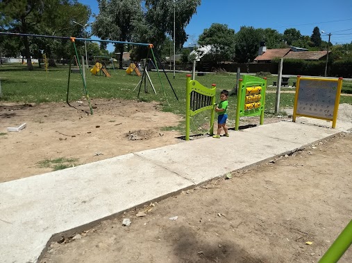
Park nearby Plaza Barrio Amankay
Argentina
Park nearby Plaza Barrio Amankay
Plaza Barrio Amankay
Maquinista Savio, Buenos Aires, Argentina
contacts phone
:
+54
Latitude:
-34.3990638
, Longitude:
-58.772453
larger map & directions
read more
nearest Park
847 m
Plaza la Madre y el Niño
Boulevard 5 de Junio, Belén de Escobar
Park
read more
1.37 km
Barrio Los Arenales
Monteagudo 1593, Ingeniero Maschwitz
Park
read more
1.566 km
Barrio Green Hill
Esteban Echeverría 2249-2299,B1623HIS, Maquinista Savio
Park
read more
1.587 km
noruegay brasil
Noruega 2798-2700, Manuel Alberti
Park
read more
1.749 km
Plaza Islas Malvinas
B1620EQO, Corrientes 699-799, Maquinista Savio
Park
read more
1.834 km
Solares Del Norte Plaza
Manuel Alberti
Park
read more
1.834 km
Plaza Solares Del Norte
Manuel Alberti
Park
read more
1.878 km
Plaza Libertad
Ingeniero Maschwitz
Park
read more
2.402 km
Quinta XV
República Argentina 3998-3900, Manuel Alberti
Park
read more
2.692 km
Barrio Cerrado El Lucero
Avenida Patricias Argentinas 4301, Garin
Park
read more
2.868 km
Chakra la Integración
4099, B1619KZC, 1 de Mayo 3999, Garin
Park
read more
3.091 km
Barrio Privado BERMUDAS
Francisco Romero 3200, Del Viso
Park
read more
3.122 km
Viñes country highland
Manuel Alberti
Park
read more
3.351 km
Plaza Emilio Mitre
Belén, Belén de Escobar
Park
read more
3.377 km
Reserva Natural de Ing Maschwitz
Ingeniero Maschwitz
Park
read more
3.393 km
Ushuaia
B1623GUE, Saavedra 1699-1749, Ingeniero Maschwitz
Park
read more
3.44 km
Parque Papa Francisco ~ Ing. Maschwitz
B1623CFP, Maipú 1425, Ingeniero Maschwitz
Park
read more
3.472 km
Plaza El Dorado
El Dorado, Avenida El Dorado, Ingeniero Maschwitz
Park
read more
3.622 km
Barrio Cuyo 2
Calle Paso, Garin
Park
read more
3.725 km
Ayres de Maschwitz
Blas Parera 550, Boulogne
Park
read more
4.507 km
Plaza Militantes de la Vida
Avenida General Belgrano, Gran Buenos Aires
Park
read more
4.709 km
COBA
calle de la cooperacion s/n
Park
read more
4.809 km
Tiro Federal San Juan
San Juan, Benavidez
Park
read more
4.898 km
Ayres de Pilar
Manuel Alberti
Park
read more
6.127 km
Los Lagartos CC, entrada
Del Viso
Park
read more
📑
all categories
Accounting
Administrative area level 1
Administrative area level 2
Airport
Amusement park
Aquarium
Art gallery
Atm
Bakery
Bank
Bar
Beauty salon
Bicycle store
Book store
Bowling alley
Bus station
Cafe
Campground
Car dealer
Car rental
Car repair
Car wash
Casino
Cemetery
Church
City hall
Clothing store
Colloquial area
Convenience store
Country
Courthouse
Dentist
Department store
Doctor
Electrician
Electronics store
Embassy
Establishment
Finance
Fire station
Florist
Food
Funeral home
Furniture store
Gas station
General contractor
Grocery or supermarket
Gym
Hair care
Hardware store
Health
Hindu Temple
Home goods store
Hospital
Insurance agency
Intersection
Jewelry store
Laundry
Lawyer
Library
Light rail station
Liquor store
Local government office
Locality
Locksmith
Lodging
Meal delivery
Meal takeaway
Mosque
Movie rental
Movie theater
Moving company
Museum
Natural feature
Neighborhood
Night club
Painter
Park
Parking
Pet store
Pharmacy
Physiotherapist
Place of worship
Plumber
Point of interest
Police
Political
Post office
Premise
Real estate agency
Restaurant
Roofing contractor
Route
Rv park, camping
School
Shoe store
Shopping mall
Spa
Stadium
Storage
Store
Subpremise
Subway station
Supermarket
Synagogue
Taxi stand
Train station
Transit station
Travel agency
University
Veterinary care
Zoo
sublocality level 1
sublocality level 3
↑