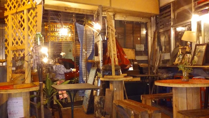
Restaurant nearby El Preferido de Palermo
Coronavirus disease (COVID-19) Situation
confirmed cases
10128845
deaths
130841
Argentina
Restaurant nearby El Preferido de Palermo
El Preferido de Palermo
2108, Jorge Luis Borges, C1425, Comuna 14, Buenos Aires, AR Argentina
contacts phone
:
+54 11 4774-6585
Latitude:
-34.5854149
, Longitude:
-58.4253483
larger map & directions
read more
nearest Restaurant
242 m
NONINO
Soler 4611
Restaurant
read more
283 m
La Estaca
C1414BVH, Nicaragua 4610
Restaurant
read more
312 m
Kanú Sushi
Jorge Luis Borges 1813, C1414DGE
Restaurant
read more
318 m
Sa Giara
Gurruchaga 1796
Restaurant
read more
363 m
Asociación Folclórica La Paila
Costa Rica 4848
Restaurant
read more
388 m
El Lambaré
Gurruchaga 1755
Restaurant
read more
443 m
Pani Salvador - Palermo Viejo
C1414BPM, El Salvador 4827
Restaurant
read more
461 m
La Leyenda
Güemes 4249
Restaurant
read more
575 m
El Galeon del Norte • Restaurante Confitería
Avenida Santa Fe 4002
Restaurant
read more
635 m
Quique's
C1414DOC, Avenida Raúl Scalabrini Ortiz 1538
Restaurant
read more
706 m
La Pascana
Paraguay 5100
Restaurant
read more
721 m
Pastis
Restaurant
read more
735 m
HELADERIA/CAFETERIA LOS AMORES
Córdoba 4583 entre Araoz y, Avenida Raúl Scalabrini Ortíz
Restaurant
read more
735 m
Açai Brasil
Serrano 1444
Restaurant
read more
737 m
Macarena. Solo Tapas
Gurruchaga 1457
Restaurant
read more
786 m
La Chochona
Gorriti 5299
Restaurant
read more
876 m
Taco Box
Lavalleja 1555-1599
Restaurant
read more
942 m
Las Cabras
Fitz Roy 1795
Restaurant
read more
990 m
Velvet
Jerónimo Salguero 1807
Restaurant
read more
1.016 km
Lo De Lucho
C1414CMZ, Bonpland 1944
Restaurant
read more
1.023 km
Delivery
Bonpland 1914
Restaurant
read more
1.104 km
Casona Vegana
y, Ángel Justiniano Carranza & Nicaragua
Restaurant
read more
1.114 km
La Casona Vegana
Viaducto Carranza 4701
Restaurant
read more
1.133 km
Epa La Arepa Palermo
Soler 5837, Buenos Aires
Restaurant
read more
1.167 km
Gerónimo
Honduras 3902
Restaurant
read more
📑
all categories
Accounting
Administrative area level 1
Administrative area level 2
Airport
Amusement park
Aquarium
Art gallery
Atm
Bakery
Bank
Bar
Beauty salon
Bicycle store
Book store
Bowling alley
Bus station
Cafe
Campground
Car dealer
Car rental
Car repair
Car wash
Casino
Cemetery
Church
City hall
Clothing store
Colloquial area
Convenience store
Country
Courthouse
Dentist
Department store
Doctor
Electrician
Electronics store
Embassy
Establishment
Finance
Fire station
Florist
Food
Funeral home
Furniture store
Gas station
General contractor
Grocery or supermarket
Gym
Hair care
Hardware store
Health
Hindu Temple
Home goods store
Hospital
Insurance agency
Intersection
Jewelry store
Laundry
Lawyer
Library
Light rail station
Liquor store
Local government office
Locality
Locksmith
Lodging
Meal delivery
Meal takeaway
Mosque
Movie rental
Movie theater
Moving company
Museum
Natural feature
Neighborhood
Night club
Painter
Park
Parking
Pet store
Pharmacy
Physiotherapist
Place of worship
Plumber
Point of interest
Police
Political
Post office
Premise
Real estate agency
Restaurant
Roofing contractor
Route
Rv park, camping
School
Shoe store
Shopping mall
Spa
Stadium
Storage
Store
Subpremise
Subway station
Supermarket
Synagogue
Taxi stand
Train station
Transit station
Travel agency
University
Veterinary care
Zoo
sublocality level 1
sublocality level 3
↑