School nearby Asociación Civil Franco Uz
Argentina
School nearby Asociación Civil Franco Uz
Asociación Civil Franco Uz
Andalgalá, C1440, Comuna 9, Buenos Aires, AR Argentina
contacts phone
:
+54 11 4686-0754
website:
www.asociacionfrancouz.org.ar
Latitude:
-34.6624094
, Longitude:
-58.5068701
larger map & directions
read more
nearest School
170 m
Tu Panacea Danza
Andalgalá 2173, C1440ENQ
School
read more
343 m
Instituto De Ingles
Avenida Coronel Cárdenas 2451
School
read more
351 m
Activ. Especial Cenfo - Cgp Número 09
School
read more
355 m
ESC N5
Tandil 6690
School
read more
382 m
Escuela N° 7 Aristobulo Del Valle
C1440FNO, Carhué 2107-2171
School
read more
473 m
Escuela Primaria Islas Malvinas
Avenida de los Corrales 7040
School
read more
542 m
NEW EVANGELICAL INSTITUTE OF CHICAGO
Tapalqué 6458
School
read more
542 m
INSTITUTO EVANGÉLICO DE NUEVA CHICAGO
Tapalqué 6458
School
read more
628 m
Madre del Buen Consejo
Avenida de los Corrales 7351
School
read more
630 m
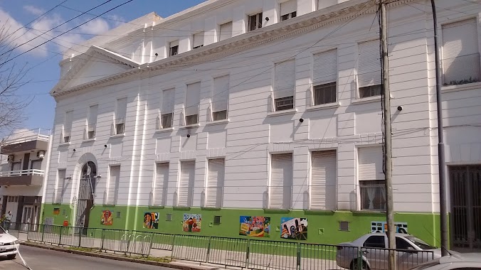
Escuela De Tizi
C1440EJP, Avenida Coronel Cárdenas 2652
School
read more
636 m
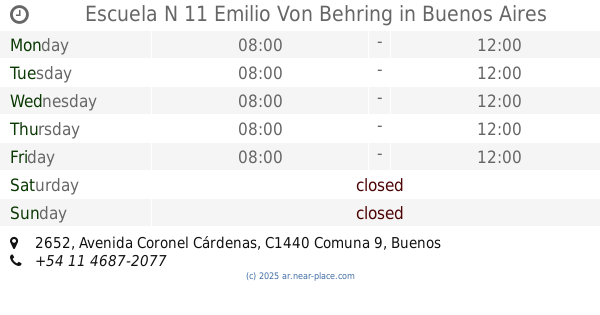
Escuela N 11 Emilio Von Behring
Avenida Coronel Cárdenas 2652
School
read more
641 m
Jardin De Infantes La Mona Jacinta
Av. Gral. Paz & José Enrique Rodó
School
read more
685 m
CURSO ACOMPAÑANTE TERAPEUTICO IACI
Avenida Juan Bautista Alberdi 6557
School
read more
703 m
Jardín Bichito de luz
Manuel Artigas 6808
School
read more
738 m
Gyunhyeong Kwan
C1440ABP, Avenida Juan Bautista Alberdi 6474
School
read more
810 m
Clases de Guitarra En Mataderos Marcelo Braun
Bragado 6220
School
read more
894 m
Leopoldo Marechal
Montiel 3015
School
read more
915 m
Leonor-apoyo Escolar
Andalgalá 1693
School
read more
937 m
Centro de Formación Profesional N 4
Carhué 2970
School
read more
1.025 km
Estudio 6 espacio artístico
Avenida Juan Bautista Alberdi 6038
School
read more
1.032 km
Instituto Madre Mercedes Pacheco
Polonia 1449, La Tablada
School
read more
1.124 km
Escuela de Educación Media Nº 02
School
read more
1.172 km
Instituto de Esclavas Concepcionistas
Av Larraz�bal 1551
School
read more
1.217 km
Colegio Divino Maestro
Panamá 4056, Lomas del Mirador
School
read more
1.362 km
Ateneo Solari Natación
Andalgalá 1395
School
read more
📑
all categories
Accounting
Administrative area level 1
Administrative area level 2
Airport
Amusement park
Aquarium
Art gallery
Atm
Bakery
Bank
Bar
Beauty salon
Bicycle store
Book store
Bowling alley
Bus station
Cafe
Campground
Car dealer
Car rental
Car repair
Car wash
Casino
Cemetery
Church
City hall
Clothing store
Colloquial area
Convenience store
Country
Courthouse
Dentist
Department store
Doctor
Electrician
Electronics store
Embassy
Establishment
Finance
Fire station
Florist
Food
Funeral home
Furniture store
Gas station
General contractor
Grocery or supermarket
Gym
Hair care
Hardware store
Health
Hindu Temple
Home goods store
Hospital
Insurance agency
Intersection
Jewelry store
Laundry
Lawyer
Library
Light rail station
Liquor store
Local government office
Locality
Locksmith
Lodging
Meal delivery
Meal takeaway
Mosque
Movie rental
Movie theater
Moving company
Museum
Natural feature
Neighborhood
Night club
Painter
Park
Parking
Pet store
Pharmacy
Physiotherapist
Place of worship
Plumber
Point of interest
Police
Political
Post office
Premise
Real estate agency
Restaurant
Roofing contractor
Route
Rv park, camping
School
Shoe store
Shopping mall
Spa
Stadium
Storage
Store
Subpremise
Subway station
Supermarket
Synagogue
Taxi stand
Train station
Transit station
Travel agency
University
Veterinary care
Zoo
sublocality level 1
sublocality level 3
↑