School nearby Institute Parish Our Lady of Unity
Argentina
School nearby Institute Parish Our Lady of Unity
Institute Parish Our Lady of Unity
2517, Navarro, C1419HSI, Comuna 15, Buenos Aires, AR Argentinien
contacts phone
:
+54 11 4574-1655
Latitude:
-34.591539
, Longitude:
-58.4907445
larger map & directions
read more
nearest School
69 m
Primary school level Ntra. Ms. Unit
Navarro 2460
School
read more
401 m
Instituto Nuestra Señora de La Unidad
Nueva York 2467
School
read more
442 m
Escuela Primaria Comun Número 03 Grecia
School
read more
444 m
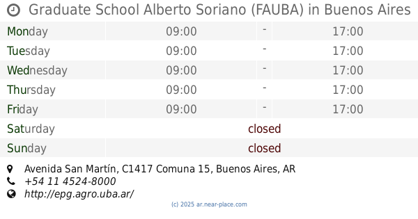
Graduate School Alberto Soriano (FAUBA)
4453, DSE, Avenida San Martín
School
read more
517 m
Esc. Alvarez Thomas
C1419DKE 3983, DKE, Terrada
School
read more
525 m
Escuela Congreso de Tucumán
Pedro Morán 2899
School
read more
650 m
FAUBA
Avenida de los Constituyentes 3489
School
read more
746 m
Instituto GLAUX - Nivel Secundario
Avenida Nazca 3330
School
read more
755 m
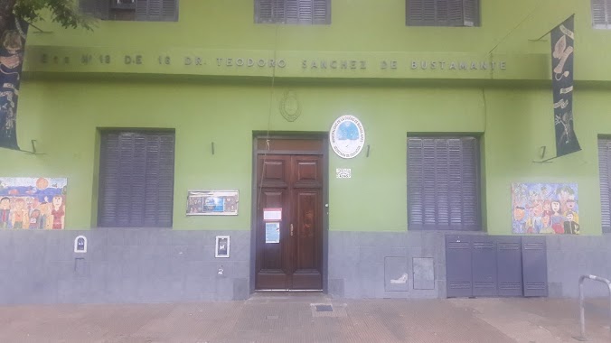
Escuela Primaria Teodoro Sánchez Bustamante
Gavilán 4246
School
read more
767 m
Escuela Técnico Profesional en Producción Agropecuaria y Agroalimentaria Fcv-Uba
School
read more
787 m
Escuela Agrotecnica
School
read more
802 m
JARDIN 907
Argerich 3500
School
read more
819 m
La casita de Anghie
Terrada C1419DKN
School
read more
835 m
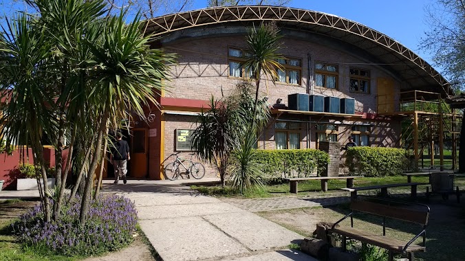
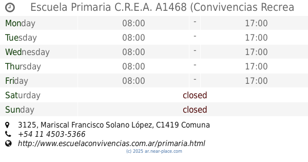
Escuela Primaria C.R.E.A. A1468 (Convivencias Recrea Educación Argentina)
Mariscal Francisco Solano López 3125
School
read more
861 m
INSTITUTO ST. MARY'S
Condarco 3142
School
read more
863 m
Profesora de Ingles
General José Gervasio Artigas 4481
School
read more
880 m
Colegio Mane
Doctor Joaquín Zabala
School
read more
887 m
Ciclo básico común Paternales
C1417DSE, Avenida San Martín 4453
School
read more
897 m
Omar
Altolaguirre 1264
School
read more
904 m
SCHOOL No. 17 D.E. 16 ° Gregoria Matorras and Ser S. Martín
Andrés Vallejos 2553
School
read more
957 m
Colegio Juan Millan
C1417CRE, Helguera 3205
School
read more
973 m
Bosque de Talar
Avenida Chorroarín 280
School
read more
983 m
Platerillo
Terrada 3080
School
read more
987 m
IEA
C1417EUF, Simbrón 3160
School
read more
1.181 km
Instituto Warrington
Condarco 4751
School
read more
📑
all categories
Accounting
Administrative area level 1
Administrative area level 2
Airport
Amusement park
Aquarium
Art gallery
Atm
Bakery
Bank
Bar
Beauty salon
Bicycle store
Book store
Bowling alley
Bus station
Cafe
Campground
Car dealer
Car rental
Car repair
Car wash
Casino
Cemetery
Church
City hall
Clothing store
Colloquial area
Convenience store
Country
Courthouse
Dentist
Department store
Doctor
Electrician
Electronics store
Embassy
Establishment
Finance
Fire station
Florist
Food
Funeral home
Furniture store
Gas station
General contractor
Grocery or supermarket
Gym
Hair care
Hardware store
Health
Hindu Temple
Home goods store
Hospital
Insurance agency
Intersection
Jewelry store
Laundry
Lawyer
Library
Light rail station
Liquor store
Local government office
Locality
Locksmith
Lodging
Meal delivery
Meal takeaway
Mosque
Movie rental
Movie theater
Moving company
Museum
Natural feature
Neighborhood
Night club
Painter
Park
Parking
Pet store
Pharmacy
Physiotherapist
Place of worship
Plumber
Point of interest
Police
Political
Post office
Premise
Real estate agency
Restaurant
Roofing contractor
Route
Rv park, camping
School
Shoe store
Shopping mall
Spa
Stadium
Storage
Store
Subpremise
Subway station
Supermarket
Synagogue
Taxi stand
Train station
Transit station
Travel agency
University
Veterinary care
Zoo
sublocality level 1
sublocality level 3
↑