School nearby Parroquia Anunciacion
Argentina
School nearby Parroquia Anunciacion
Parroquia Anunciacion
2041, Altolaguirre, C1431, Comuna 12, Buenos Aires, AR Argentina
contacts phone
:
+54
Latitude:
-34.5803536
, Longitude:
-58.4881358
larger map & directions
read more
nearest School
100 m
Colegio Parroquial Nuestra Señora de la Anunciación
C1431EAN, Barzana 2040
School
read more
302 m
Asociación Civil y Cultural APAIB
Mendoza 5846
School
read more
458 m
Audio Visual - Escuela de sonido
Avenida Monroe 5552
School
read more
503 m
Saint Jean
Avenida Monroe 5352
School
read more
516 m
Emanuel Mercedes
La Pampa 5321
School
read more
576 m
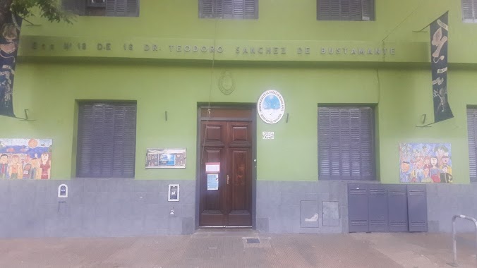
Escuela Primaria Teodoro Sánchez Bustamante
Gavilán 4246
School
read more
598 m
Instituto Tomás Devoto
Franklin D. Roosevelt 5678, Buenos Aires
School
read more
645 m
La Tortuga Viajera
Avenida Triunvirato 4445
School
read more
687 m
Esba Urquiza
Avenida Monroe 5048, C1431CAP
School
read more
691 m
Ashtanga Yoga Urquiza
FBG, Avenida Triunvirato 4311
School
read more
765 m
Profesora de Matematica -silvia
Avenida General Mosconi 2362
School
read more
771 m
Colegio Saint Jean
Doctor Pedro Ignacio Rivera 5445
School
read more
789 m
Taller de Fileteado Porteño
Andonaegui 2720
School
read more
813 m
Clases de Música en Urquiza: Piano, Guitarra y Canto
Doctor Pedro Ignacio Rivera 5317
School
read more
865 m
School No. 12 Reconquista
Avenida Triunvirato 4992
School
read more
902 m
Clases Particulares
Pasaje Fernandez Blanco 2065, (Planta baja, timbre 1), Villa Urquiza
School
read more
903 m
ESCUELA No. 8 JORGE A. BOERO
Juramento 4849
School
read more
911 m
Profesora de Ingles
General José Gervasio Artigas 4481
School
read more
966 m
Instituto Nuestra Señora de La Unidad
Nueva York 2467
School
read more
991 m
Escuela 1 Distrito 15
Villa Urquiza
School
read more
1.007 km
Pa' Bailar
4831, Avenida Monroe
School
read more
1.022 km
Funda Stranger
Avenida Monroe 4819-4897, C1431CAI
School
read more
1.052 km
FAUBA
Avenida de los Constituyentes 3489
School
read more
1.172 km
Omar
Altolaguirre 1264
School
read more
1.259 km
I.T Colegio Mayor
Lugones 2234
School
read more
📑
all categories
Accounting
Administrative area level 1
Administrative area level 2
Airport
Amusement park
Aquarium
Art gallery
Atm
Bakery
Bank
Bar
Beauty salon
Bicycle store
Book store
Bowling alley
Bus station
Cafe
Campground
Car dealer
Car rental
Car repair
Car wash
Casino
Cemetery
Church
City hall
Clothing store
Colloquial area
Convenience store
Country
Courthouse
Dentist
Department store
Doctor
Electrician
Electronics store
Embassy
Establishment
Finance
Fire station
Florist
Food
Funeral home
Furniture store
Gas station
General contractor
Grocery or supermarket
Gym
Hair care
Hardware store
Health
Hindu Temple
Home goods store
Hospital
Insurance agency
Intersection
Jewelry store
Laundry
Lawyer
Library
Light rail station
Liquor store
Local government office
Locality
Locksmith
Lodging
Meal delivery
Meal takeaway
Mosque
Movie rental
Movie theater
Moving company
Museum
Natural feature
Neighborhood
Night club
Painter
Park
Parking
Pet store
Pharmacy
Physiotherapist
Place of worship
Plumber
Point of interest
Police
Political
Post office
Premise
Real estate agency
Restaurant
Roofing contractor
Route
Rv park, camping
School
Shoe store
Shopping mall
Spa
Stadium
Storage
Store
Subpremise
Subway station
Supermarket
Synagogue
Taxi stand
Train station
Transit station
Travel agency
University
Veterinary care
Zoo
sublocality level 1
sublocality level 3
↑