Store nearby Oggun Soluciones Informaticas
Argentina
Store nearby Oggun Soluciones Informaticas
Oggun Soluciones Informaticas
1450, Pumacahua, C1406, Comuna 7, Buenos Aires, AR Argentina
contacts phone
:
+54 11 2061-8859
Latitude:
-34.6399901
, Longitude:
-58.4457415
larger map & directions
read more
nearest Store
263 m
Herran Ofelia
Avelino Díaz 1702
Store
read more
327 m
PERRUNYKO'S PET SHOP - PERRUQUERIA - PET STORE - PELUQUERIA CANINA - BAÑOS Y CORTES DE RAZA
C1406DAZ, Curapaligüe 1250
Store
read more
370 m
Roger Rogelio Cruz Horta
Avenida Castañares 2161
Store
read more
526 m
Feria Bonorino
2300,, Avenida Castañares 2230
Store
read more
546 m
Óptica La Gracia
Avenida Carabobo 1035
Store
read more
553 m
Locos de Asar
Avenida Eva Perón 1780
Store
read more
565 m
Carnes Recanto Pampeano
Avenida Eva Perón 2001
Store
read more
737 m
Mecanico ezequiel
Saraza 1411
Store
read more
772 m
Clemente
Avenida Eva Perón 2317
Store
read more
862 m
Dinamit
Miraflores2148/64, Flores
Store
read more
897 m
karibe 26
1999,, Emilio Mitre 1977, Buenos Aires
Store
read more
902 m
Óptica Patagonia
Avenida Varela 1275
Store
read more
904 m
Frutería y Verdulería Andy
Avenida Asamblea 928
Store
read more
909 m
Albricias blanquería
Avenida Asamblea 928
Store
read more
913 m
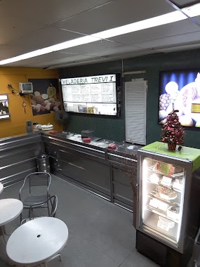
Heladeria Trevi I
Avenida Varela 1239
Store
read more
920 m
Puesto Diarios
C1406CXP, Malvinas Argentinas 706
Store
read more
921 m
AROMAS Y AROMATIZADORES
Avenida Varela 1194
Store
read more
926 m
Alan Carnicería
Mercado Varela, Avenida Varela 1184
Store
read more
968 m
Mojokio Tatoo Studio
Avenida Varela 1136
Store
read more
977 m
Grow Shop Kill me Lemon
Avenida Eva Perón 2543
Store
read more
986 m
Heladería Vermelho
Avenida Varela 1135
Store
read more
993 m
Freddo
Avenida Asamblea 869
Store
read more
1.061 km
Estanterías Grecia
Santander 1102
Store
read more
1.212 km
CARNES PAMPEANAS
Avenida Directorio 1906
Store
read more
1.257 km
Perfumerias Daniel
Avenida Directorio 1984
Store
read more
📑
all categories
Accounting
Administrative area level 1
Administrative area level 2
Airport
Amusement park
Aquarium
Art gallery
Atm
Bakery
Bank
Bar
Beauty salon
Bicycle store
Book store
Bowling alley
Bus station
Cafe
Campground
Car dealer
Car rental
Car repair
Car wash
Casino
Cemetery
Church
City hall
Clothing store
Colloquial area
Convenience store
Country
Courthouse
Dentist
Department store
Doctor
Electrician
Electronics store
Embassy
Establishment
Finance
Fire station
Florist
Food
Funeral home
Furniture store
Gas station
General contractor
Grocery or supermarket
Gym
Hair care
Hardware store
Health
Hindu Temple
Home goods store
Hospital
Insurance agency
Intersection
Jewelry store
Laundry
Lawyer
Library
Light rail station
Liquor store
Local government office
Locality
Locksmith
Lodging
Meal delivery
Meal takeaway
Mosque
Movie rental
Movie theater
Moving company
Museum
Natural feature
Neighborhood
Night club
Painter
Park
Parking
Pet store
Pharmacy
Physiotherapist
Place of worship
Plumber
Point of interest
Police
Political
Post office
Premise
Real estate agency
Restaurant
Roofing contractor
Route
Rv park, camping
School
Shoe store
Shopping mall
Spa
Stadium
Storage
Store
Subpremise
Subway station
Supermarket
Synagogue
Taxi stand
Train station
Transit station
Travel agency
University
Veterinary care
Zoo
sublocality level 1
sublocality level 3
↑