Supermarket nearby Feria Itinerante de Abastecimiento Barrial - FIAB 19
Argentina
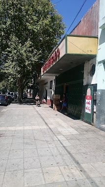
Supermarket nearby Feria Itinerante de Abastecimiento Barrial - FIAB 19
Feria Itinerante de Abastecimiento Barrial - FIAB 19
C1255ABR, José Mármol 1802 Argentina
contacts phone
:
+54
Latitude:
-34.6358537
, Longitude:
-58.4218147
read more
nearest Supermarket
192 m
Sin Barrio
Avenida La Plata 1768, Buenos Aires
Supermarket
read more
301 m
Inclan
Inclán 4243
Supermarket
read more
318 m
Innc La Plata
Inclán 4302-4370
Supermarket
read more
353 m
supermercado Jonas
Avelino Díaz 333
Supermarket
read more
416 m
Dia
C1250AAS, Avenida La Plata 1570
Supermarket
read more
466 m
Supermercados DIA
Avenida La Plata 2186
Supermarket
read more
568 m
SUPERMERCADO MEGA
Pavón 4237
Supermarket
read more
673 m
Supermercado Amor
Avenida Boedo 1564
Supermarket
read more
679 m
Carrefour Express
Avenida Caseros 3535
Supermarket
read more
690 m
Express Avenida Caseros 3535
Avenida Caseros 3535
Supermarket
read more
695 m
SUPERMERCADO HUA LONG
Pavón 3883
Supermarket
read more
707 m
HONG ZIKUN
Avenida Boedo 1550
Supermarket
read more
741 m
COTO
Avenida La Plata 2392
Supermarket
read more
788 m
Dia
C1250AAC, Avenida La Plata 1216
Supermarket
read more
792 m
Vidrios Espejos Colocion En Obra
Avenida La Plata 1226
Supermarket
read more
793 m
Jia Yuan
Avenida General Francisco Fernández de la Cruz 817
Supermarket
read more
852 m
zhengyaqing
Avenida La Plata 1190
Supermarket
read more
858 m
Día Market
Avenida Cobo 901-903
Supermarket
read more
896 m
Supermercado Duo Duo
Avenida Cobo 938
Supermarket
read more
907 m
Supermercado Divino
Virrey Liniers 1826
Supermarket
read more
940 m
Supermercado Jose Maria Moreno 1232
Avenida José María Moreno 1232
Supermarket
read more
944 m
Supermercado Liu
Avenida La Plata 2537
Supermarket
read more
1.017 km
张硕
Avenida La Plata 1047, C1250AAAAAA
Supermarket
read more
1.136 km
Supermercados DIA
Avenida Directorio 134
Supermarket
read more
1.168 km
Supermercado Alianza
Avenida Directorio 192
Supermarket
read more
📑
all categories
Accounting
Administrative area level 1
Administrative area level 2
Airport
Amusement park
Aquarium
Art gallery
Atm
Bakery
Bank
Bar
Beauty salon
Bicycle store
Book store
Bowling alley
Bus station
Cafe
Campground
Car dealer
Car rental
Car repair
Car wash
Casino
Cemetery
Church
City hall
Clothing store
Colloquial area
Convenience store
Country
Courthouse
Dentist
Department store
Doctor
Electrician
Electronics store
Embassy
Establishment
Finance
Fire station
Florist
Food
Funeral home
Furniture store
Gas station
General contractor
Grocery or supermarket
Gym
Hair care
Hardware store
Health
Hindu Temple
Home goods store
Hospital
Insurance agency
Intersection
Jewelry store
Laundry
Lawyer
Library
Light rail station
Liquor store
Local government office
Locality
Locksmith
Lodging
Meal delivery
Meal takeaway
Mosque
Movie rental
Movie theater
Moving company
Museum
Natural feature
Neighborhood
Night club
Painter
Park
Parking
Pet store
Pharmacy
Physiotherapist
Place of worship
Plumber
Point of interest
Police
Political
Post office
Premise
Real estate agency
Restaurant
Roofing contractor
Route
Rv park, camping
School
Shoe store
Shopping mall
Spa
Stadium
Storage
Store
Subpremise
Subway station
Supermarket
Synagogue
Taxi stand
Train station
Transit station
Travel agency
University
Veterinary care
Zoo
sublocality level 1
sublocality level 3
↑