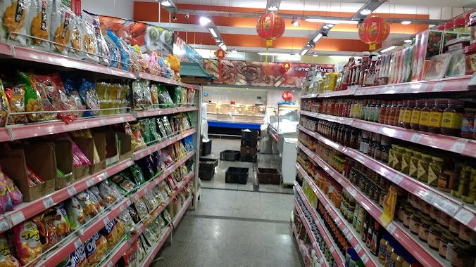
Supermarket nearby Supermercado
Argentina
Supermarket nearby Supermercado
Supermercado
1742, Migueletes, C1426, C1426BVB, Comuna 13, AR Argentina
contacts phone
:
+54
Latitude:
-34.5593816
, Longitude:
-58.4438421
larger map & directions
read more
nearest Supermarket
310 m
Carrefour Express Echeverría 1420
Echeverría 1420
Supermarket
read more
398 m
HUANG GUODONG
Echeverría 1602
Supermarket
read more
434 m
Supermercados Día
Montañeses 2014, Belgrano
Supermarket
read more
501 m
Aric Express
Migueletes 1338
Supermarket
read more
501 m
AMISTAD
Juramento 1573
Supermarket
read more
585 m
Supermercado Delfín
Avenida Luis María Campos 1323
Supermarket
read more
593 m
Las Estrellas
Mendoza 1417
Supermarket
read more
636 m
Carrefour Market Lacroze
Avenida Federico Lacroze 1755
Supermarket
read more
644 m
Supermercados DIA
Avenida del Libertador 6144
Supermarket
read more
778 m
Huang Xiue
Avenida Olazábal 1645
Supermarket
read more
787 m
ChungHwa
Olazábal 1673
Supermarket
read more
790 m
SuperChungHwa
Olazabal 1673
Supermarket
read more
875 m
Supermercado Corazón
Soldado de la Independencia 1065
Supermarket
read more
886 m
La Gran Muralla China
3 de Febrero 2240
Supermarket
read more
921 m
Supermercado "Oro"
Avenida Federico Lacroze 2173
Supermarket
read more
957 m
Día
C1426CPT, Avenida Federico Lacroze 2178
Supermarket
read more
974 m
Autoservicio Victoria
Arribeños 2461
Supermarket
read more
991 m
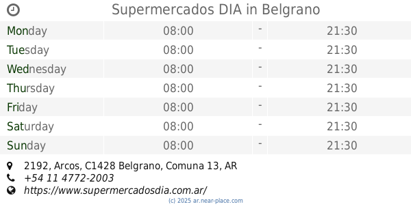
Supermercados DIA
Arcos 2192, Belgrano
Supermarket
read more
1.002 km
Supermercado Las Cañitas
Migueletes 961
Supermarket
read more
1.07 km
Día
Avenida Cabildo 1434
Supermarket
read more
1.238 km
Supermercado Wong
Avenida del Libertador 6660
Supermarket
read more
1.272 km
Carrefour Express
Virrey del Pino 2527
Supermarket
read more
1.319 km
Supermercado Chino
C1429BMN, Avenida del Libertador 6710
Supermarket
read more
1.331 km
Mini Market
Amenábar 1569
Supermarket
read more
1.331 km
Supermercado 1569
Amenábar 1569
Supermarket
read more
📑
all categories
Accounting
Administrative area level 1
Administrative area level 2
Airport
Amusement park
Aquarium
Art gallery
Atm
Bakery
Bank
Bar
Beauty salon
Bicycle store
Book store
Bowling alley
Bus station
Cafe
Campground
Car dealer
Car rental
Car repair
Car wash
Casino
Cemetery
Church
City hall
Clothing store
Colloquial area
Convenience store
Country
Courthouse
Dentist
Department store
Doctor
Electrician
Electronics store
Embassy
Establishment
Finance
Fire station
Florist
Food
Funeral home
Furniture store
Gas station
General contractor
Grocery or supermarket
Gym
Hair care
Hardware store
Health
Hindu Temple
Home goods store
Hospital
Insurance agency
Intersection
Jewelry store
Laundry
Lawyer
Library
Light rail station
Liquor store
Local government office
Locality
Locksmith
Lodging
Meal delivery
Meal takeaway
Mosque
Movie rental
Movie theater
Moving company
Museum
Natural feature
Neighborhood
Night club
Painter
Park
Parking
Pet store
Pharmacy
Physiotherapist
Place of worship
Plumber
Point of interest
Police
Political
Post office
Premise
Real estate agency
Restaurant
Roofing contractor
Route
Rv park, camping
School
Shoe store
Shopping mall
Spa
Stadium
Storage
Store
Subpremise
Subway station
Supermarket
Synagogue
Taxi stand
Train station
Transit station
Travel agency
University
Veterinary care
Zoo
sublocality level 1
sublocality level 3
↑