Synagogue nearby Templo Camargo - ACISBA
Argentina
Synagogue nearby Templo Camargo - ACISBA
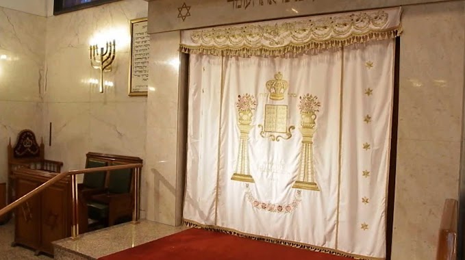
Templo Camargo - ACISBA
870, Camargo, C1414, Comuna 15, Buenos Aires, AR Argentina
contacts phone
:
+54 11 4855-6945
Latitude:
-34.597628
, Longitude:
-58.443317
larger map & directions
read more
nearest Synagogue
534 m
Asociacion Comunitaria Israelita
C1414DEP, Serrano 780
Synagogue
read more
686 m
Comunidad Brit-Abraham
C1414EEC, Antezana 145
Synagogue
read more
686 m
Community Brit-Abraham - Shil de Antezana
C1414EEC, Antezana 145
Synagogue
read more
990 m
Beit Jabad
Julián Álvarez 745
Synagogue
read more
1.607 km
Comunidad Or Israel
Planes 1049, Buenos Aires
Synagogue
read more
1.959 km
ACILBA
C1414DGH, Jorge Luis Borges 1932
Synagogue
read more
2.041 km
Iarjo Jabad
Lavalle 3928
Synagogue
read more
2.5 km
Centro Mesiánico Derej Haemuna
AAB, Sarmiento 3726, Buenos Aires
Synagogue
read more
2.537 km
Sinagoga Chalom
Olleros 2876
Synagogue
read more
2.604 km
Beit Jabad Almagro
Billinghurst 664
Synagogue
read more
2.82 km
Templo Sutton
Tucumán 3326
Synagogue
read more
2.822 km
Templo Od yosef jai
Tucumán 3326
Synagogue
read more
2.843 km
Beit Jabad Lamas (Flores)
Andrés Lamas 771
Synagogue
read more
3.233 km
Comunidad Bet Hilel
C1425DGT, Aráoz 2854
Synagogue
read more
3.372 km
Bet Midrash Ohel Iosef Moshe
C1214ACN, Ecuador 850
Synagogue
read more
3.384 km
Mekor Jaim
Gavilán 460, C1406BBF
Synagogue
read more
3.385 km
Beit Jabad Buschiazzo
Juan A. Buschiazzo 3026
Synagogue
read more
3.454 km
Yeshurún Templo Sefaradí
C1425FCG, República de la India 3035
Synagogue
read more
3.517 km
Colel
Tucumán 2728, Buenos Aires
Synagogue
read more
3.565 km
Asociacion Hebrea Argentina de Socorros Mutuos
Avenida Pueyrredón 645
Synagogue
read more
4 km
Yeshiba Jajam Nissim Cohen
Felipe Vallese 2953
Synagogue
read more
4.114 km
Templo Mohadeb Salomon
Felipe Vallese 3047
Synagogue
read more
4.208 km
Beit Jabad Flores
Helguera 634
Synagogue
read more
4.208 km
ASOCIACIÓN ISRAELITA ARGENTINA JABAD FLORES - BEIT JABAD LUBAVITCH
Helguera 634
Synagogue
read more
4.66 km
Asociacion Israelita Sefaradi Luz
Ciudad de La Paz 2555
Synagogue
read more
📑
all categories
Accounting
Administrative area level 1
Administrative area level 2
Airport
Amusement park
Aquarium
Art gallery
Atm
Bakery
Bank
Bar
Beauty salon
Bicycle store
Book store
Bowling alley
Bus station
Cafe
Campground
Car dealer
Car rental
Car repair
Car wash
Casino
Cemetery
Church
City hall
Clothing store
Colloquial area
Convenience store
Country
Courthouse
Dentist
Department store
Doctor
Electrician
Electronics store
Embassy
Establishment
Finance
Fire station
Florist
Food
Funeral home
Furniture store
Gas station
General contractor
Grocery or supermarket
Gym
Hair care
Hardware store
Health
Hindu Temple
Home goods store
Hospital
Insurance agency
Intersection
Jewelry store
Laundry
Lawyer
Library
Light rail station
Liquor store
Local government office
Locality
Locksmith
Lodging
Meal delivery
Meal takeaway
Mosque
Movie rental
Movie theater
Moving company
Museum
Natural feature
Neighborhood
Night club
Painter
Park
Parking
Pet store
Pharmacy
Physiotherapist
Place of worship
Plumber
Point of interest
Police
Political
Post office
Premise
Real estate agency
Restaurant
Roofing contractor
Route
Rv park, camping
School
Shoe store
Shopping mall
Spa
Stadium
Storage
Store
Subpremise
Subway station
Supermarket
Synagogue
Taxi stand
Train station
Transit station
Travel agency
University
Veterinary care
Zoo
sublocality level 1
sublocality level 3
↑