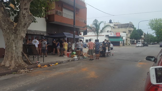
Night club nearby BULO
Argentina
Night club nearby BULO
BULO
y, Avenida Juan Bautista Alberdi, C1440, Comuna 9, Buenos Aires, AR Argentina
contacts phone
:
+54
Latitude:
-34.6476174
, Longitude:
-58.4983292
larger map & directions
read more
nearest Night club
387 m
La Casa de Emilio
Avenida Emilio Castro 5275
Night club
read more
479 m
Gama Eventos
Bragado 5716
Night club
read more
737 m
Clud Chicas
Avenida Juan Bautista Alberdi 4694, Buenos Aires
Night club
read more
752 m
Camicha Autoservicii
Avenida Directorio 5100
Night club
read more
826 m
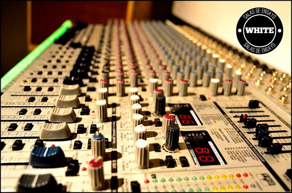
WHITE SALA DE ENSAYO
C1407IIJ, White 424
Night club
read more
851 m
Revival Espacio para Eventos
Oliden 1273
Night club
read more
874 m
Sala Andando
Ercilla 5725, C1408IPM
Night club
read more
1.004 km
Novioooo
C1407IFX, Homero 1168
Night club
read more
1.036 km
Filomena Eventos
Murguiondo 1300
Night club
read more
1.226 km
El Kiosco (Ek)
C1440DYA, Martiniano Leguizamón 1201-1203
Night club
read more
1.363 km
9131 Eventos
Avenida Rivadavia 9131
Night club
read more
1.548 km
Parrilla El Mariscal
Bermúdez 312, C1407BDD
Night club
read more
1.593 km
AUTOMOTOR
C1408IGR, Avenida Emilio Castro 6780
Night club
read more
1.6 km
Seba Fest
Fernández 250
Night club
read more
1.824 km
Chatteau Farias
Doctor Juan Felipe Aranguren 4701-4749
Night club
read more
1.898 km
Trabajo ALEJANDRO
C1408GQS, Timoteo Gordillo 999
Night club
read more
1.907 km
La Casa de las Fiestas
Moliere 784
Night club
read more
1.994 km
Micros Bayside
José León Suárez 1049
Night club
read more
2.024 km
El Bunker T
Moreto 1616-1650
Night club
read more
2.142 km
Mvseo Rock Vivo
Avenida Rivadavia 1102
Night club
read more
2.203 km
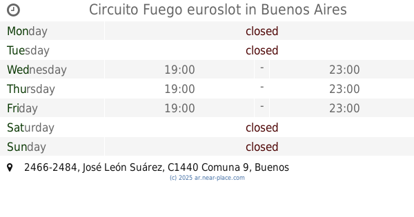
Circuito Fuego euroslot
C1440EYT, José León Suárez 2466-2484
Night club
read more
2.44 km
Salón Plaisir
Zuviría 4915
Night club
read more
2.506 km
Salón Zabala Paz
Avenida General Paz 12585
Night club
read more
2.574 km
Radio Metropolitana En Avellaneda
C1407EDG, Bacacay 3633
Night club
read more
2.641 km
Bravo inflables
Avenida Álvarez Jonte 6069
Night club
read more
📑
all categories
Accounting
Administrative area level 1
Administrative area level 2
Airport
Amusement park
Aquarium
Art gallery
Atm
Bakery
Bank
Bar
Beauty salon
Bicycle store
Book store
Bowling alley
Bus station
Cafe
Campground
Car dealer
Car rental
Car repair
Car wash
Casino
Cemetery
Church
City hall
Clothing store
Colloquial area
Convenience store
Country
Courthouse
Dentist
Department store
Doctor
Electrician
Electronics store
Embassy
Establishment
Finance
Fire station
Florist
Food
Funeral home
Furniture store
Gas station
General contractor
Grocery or supermarket
Gym
Hair care
Hardware store
Health
Hindu Temple
Home goods store
Hospital
Insurance agency
Intersection
Jewelry store
Laundry
Lawyer
Library
Light rail station
Liquor store
Local government office
Locality
Locksmith
Lodging
Meal delivery
Meal takeaway
Mosque
Movie rental
Movie theater
Moving company
Museum
Natural feature
Neighborhood
Night club
Painter
Park
Parking
Pet store
Pharmacy
Physiotherapist
Place of worship
Plumber
Point of interest
Police
Political
Post office
Premise
Real estate agency
Restaurant
Roofing contractor
Route
Rv park, camping
School
Shoe store
Shopping mall
Spa
Stadium
Storage
Store
Subpremise
Subway station
Supermarket
Synagogue
Taxi stand
Train station
Transit station
Travel agency
University
Veterinary care
Zoo
sublocality level 1
sublocality level 3
↑