Night club nearby El Bunker T
Coronavirus disease (COVID-19) Situation
confirmed cases
10128845
deaths
130841
Argentina
Night club nearby El Bunker T
El Bunker T
1616-1650, Moreto, C1407, Comuna 9, Buenos Aires, AR Argentina
contacts phone
:
+54
Latitude:
-34.652353
, Longitude:
-58.4769605
larger map & directions
read more
nearest Night club
361 m
Canchas De Fútbol
Mozart 1807
Night club
read more
503 m
Guernica
Avenida Eva Perón
Night club
read more
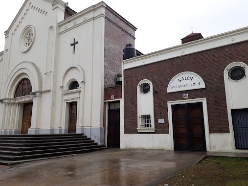
802 m
Salón Olmos
Avenida Escalada 2374
Night club
read more
1.034 km
Novioooo
C1407IFX, Homero 1168
Night club
read more
1.085 km
El Parke LunaTiko
Avenida Olivera 666
Night club
read more
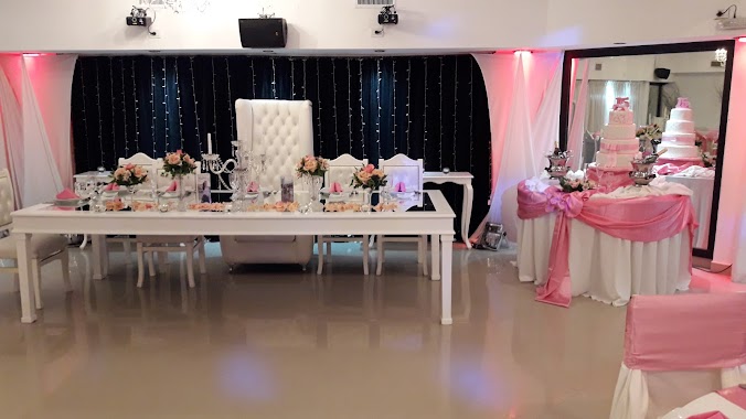
1.181 km
Salón Plaisir
Zuviría 4915
Night club
read more
1.289 km
La casa
Santander 4746
Night club
read more
1.333 km
Camicha Autoservicii
Avenida Directorio 5100
Night club
read more
1.692 km
Clud Chicas
Avenida Juan Bautista Alberdi 4694, Buenos Aires
Night club
read more
1.764 km
Seba Fest
Fernández 250
Night club
read more
1.835 km
Sede Viejo
C1406HAH, Avenida Directorio 3183
Night club
read more
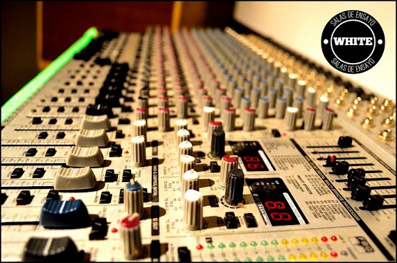
1.836 km
WHITE SALA DE ENSAYO
C1407IIJ, White 424
Night club
read more
1.996 km
Salon Fco Bilbao 2930
C1406FGE, Francisco Bilbao 2883
Night club
read more
2.024 km
BULO
Corvalan, Avenida Juan Bautista Alberdi y
Night club
read more
2.243 km
Remiseria La Perla
Villa Lugano
Night club
read more
2.297 km
9131 Eventos
Avenida Rivadavia 9131
Night club
read more
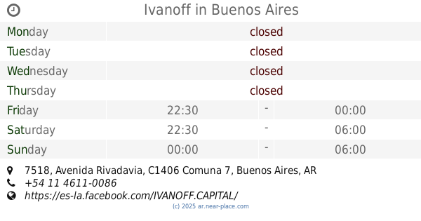
2.391 km
Ivanoff
Avenida Rivadavia 7518
Night club
read more
2.454 km
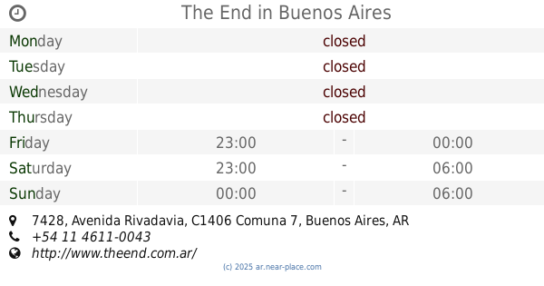
The End
Avenida Rivadavia 7428
Night club
read more
2.492 km
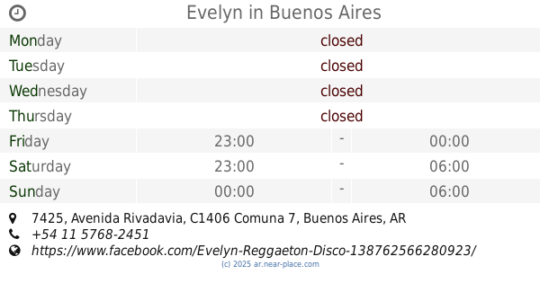
Evelyn
Avenida Rivadavia 7425
Night club
read more
2.582 km
AMNESIA
Avenida Nazca 55
Night club
read more
2.625 km
La Porteña Milonga
Avenida Avellaneda 3885
Night club
read more
2.725 km
Revival Espacio para Eventos
Oliden 1273
Night club
read more
2.739 km
Chatteau Farias
Doctor Juan Felipe Aranguren 4701-4749
Night club
read more
3.277 km
Casa Elba
Mariano Acosta 3417
Night club
read more
3.408 km
Disco-Bar Seu
Avenida Boyacá 28
Night club
read more
📑
all categories
Accounting
Administrative area level 1
Administrative area level 2
Airport
Amusement park
Aquarium
Art gallery
Atm
Bakery
Bank
Bar
Beauty salon
Bicycle store
Book store
Bowling alley
Bus station
Cafe
Campground
Car dealer
Car rental
Car repair
Car wash
Casino
Cemetery
Church
City hall
Clothing store
Colloquial area
Convenience store
Country
Courthouse
Dentist
Department store
Doctor
Electrician
Electronics store
Embassy
Establishment
Finance
Fire station
Florist
Food
Funeral home
Furniture store
Gas station
General contractor
Grocery or supermarket
Gym
Hair care
Hardware store
Health
Hindu Temple
Home goods store
Hospital
Insurance agency
Intersection
Jewelry store
Laundry
Lawyer
Library
Light rail station
Liquor store
Local government office
Locality
Locksmith
Lodging
Meal delivery
Meal takeaway
Mosque
Movie rental
Movie theater
Moving company
Museum
Natural feature
Neighborhood
Night club
Painter
Park
Parking
Pet store
Pharmacy
Physiotherapist
Place of worship
Plumber
Point of interest
Police
Political
Post office
Premise
Real estate agency
Restaurant
Roofing contractor
Route
Rv park, camping
School
Shoe store
Shopping mall
Spa
Stadium
Storage
Store
Subpremise
Subway station
Supermarket
Synagogue
Taxi stand
Train station
Transit station
Travel agency
University
Veterinary care
Zoo
sublocality level 1
sublocality level 3
↑