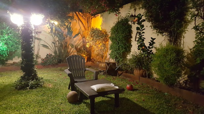
Park nearby Amigos de las Artes
Coronavirus disease (COVID-19) Situation
confirmed cases
10128845
deaths
130841
Argentina
Park nearby Amigos de las Artes
Amigos de las Artes
Buenos Aires, CABA, Argentina
contacts phone
:
+54
Latitude:
-34.6375709
, Longitude:
-58.4954437
larger map & directions
read more
nearest Park
135 m
Plazoleta Los Amigos
C1407IFD, Homero 102-166
Park
read more
214 m
Vicente Bellini
Avenida Rivadavia 9175-9179
Park
read more
277 m
Plaza Hugo Ricardo Corradi
Park
read more
313 m
León Fontova
Medina 102-120
Park
read more
560 m
Plaza Yerbal
C1407EAY, Yerbal 4501-4599
Park
read more
671 m
Plazoleta Alberto Castillo
Villa Luro
Park
read more
673 m
Carlos Gardel
Park
read more
751 m
Prof. Ernesto Nelson
Villa Luro
Park
read more
861 m
Boulevard Juan Bautista Justo
C1407FBU, Avenida Juan Bautista Justo 8232
Park
read more
952 m
Gnc Service
8658,, Avenida Rivadavia 8642
Park
read more
965 m
Plaza de la Bandera
Avenida Juan Bautista Justo
Park
read more
1.224 km
Plaza Cnel. Ramón L. Falcón
Coronel Ramón Lorenzo Falcón
Park
read more
1.254 km
Plaza Los Andes
Avenida Rivadavia
Park
read more
1.355 km
Plaza
Gualeguaychú 800-752
Park
read more
1.379 km
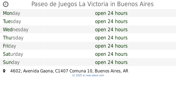
Paseo de Juegos La Victoria
C1407FIV, Avenida Gaona 4602
Park
read more
1.702 km
Plaza de Isidora
Caaguazú 5901-5999, C1408ETE
Park
read more
1.746 km
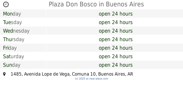
Plaza Don Bosco
Avenida Lope de Vega 1485
Park
read more
1.836 km
Expreso Alegria Tren Parque Avellaneda
Acceso privado dentro del Parque Camino para personal del Peaje Avellaneda. 202
Park
read more
1.843 km
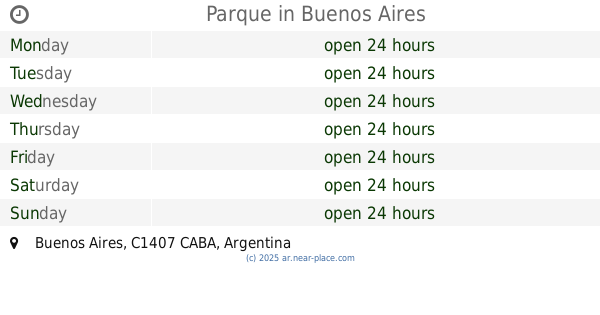
Parque
Park
read more
1.849 km
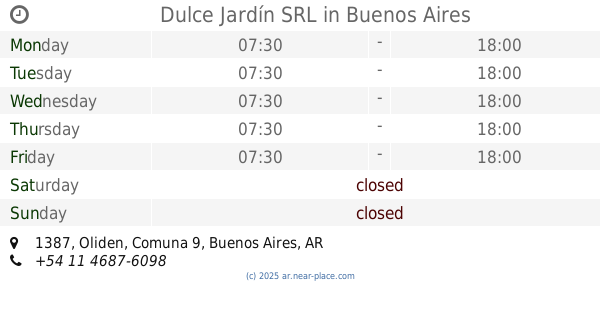
Dulce Jardín SRL
Oliden 1387
Park
read more
1.959 km
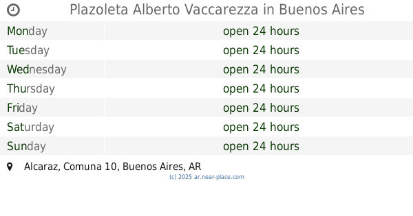
Plazoleta Alberto Vaccarezza
Alcaraz
Park
read more
2.036 km
Parque Santojanni
899, C1408GYQ, Murguiondo 801
Park
read more
2.144 km
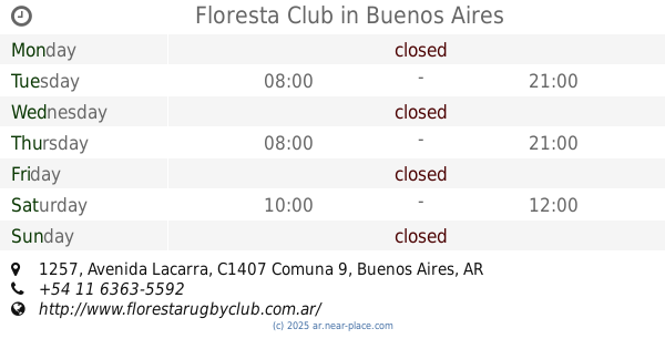
Floresta Club
C1407JQY, Avenida Lacarra 1257
Park
read more
2.318 km
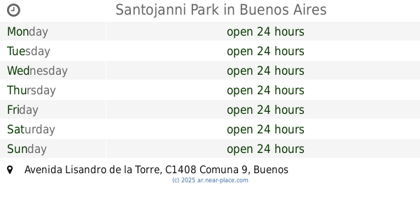
Santojanni Park
Avenida Lisandro de la Torre
Park
read more
2.607 km
Irma Carrica
Avenida San Juan Bautista de la Salle 2182-2200
Park
read more
📑
all categories
Accounting
Administrative area level 1
Administrative area level 2
Airport
Amusement park
Aquarium
Art gallery
Atm
Bakery
Bank
Bar
Beauty salon
Bicycle store
Book store
Bowling alley
Bus station
Cafe
Campground
Car dealer
Car rental
Car repair
Car wash
Casino
Cemetery
Church
City hall
Clothing store
Colloquial area
Convenience store
Country
Courthouse
Dentist
Department store
Doctor
Electrician
Electronics store
Embassy
Establishment
Finance
Fire station
Florist
Food
Funeral home
Furniture store
Gas station
General contractor
Grocery or supermarket
Gym
Hair care
Hardware store
Health
Hindu Temple
Home goods store
Hospital
Insurance agency
Intersection
Jewelry store
Laundry
Lawyer
Library
Light rail station
Liquor store
Local government office
Locality
Locksmith
Lodging
Meal delivery
Meal takeaway
Mosque
Movie rental
Movie theater
Moving company
Museum
Natural feature
Neighborhood
Night club
Painter
Park
Parking
Pet store
Pharmacy
Physiotherapist
Place of worship
Plumber
Point of interest
Police
Political
Post office
Premise
Real estate agency
Restaurant
Roofing contractor
Route
Rv park, camping
School
Shoe store
Shopping mall
Spa
Stadium
Storage
Store
Subpremise
Subway station
Supermarket
Synagogue
Taxi stand
Train station
Transit station
Travel agency
University
Veterinary care
Zoo
sublocality level 1
sublocality level 3
↑