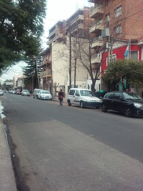
Bus station nearby Luis Pasteur 2594
Argentina
Bus station nearby Luis Pasteur 2594
Luis Pasteur 2594
Castelar, Provincia de Buenos Aires, Argentina
contacts phone
:
+54
Latitude:
-34.6597328
, Longitude:
-58.6425568
larger map & directions
read more
nearest Bus station
240 m
Fray Justo Santa María de Oro 2399-2551
Argentina
Bus station
read more
274 m
Gobernador Luis Monteverde 859
Argentina
Bus station
read more
341 m
Avenida Figueroa Alcorta 506-598
Argentina
Bus station
read more
403 m
Avenida Estanislao Zeballos 2879
Argentina
Bus station
read more
406 m
Avenida Estanislao Zeballos 2862-2880
Argentina
Bus station
read more
436 m
Fray Justo Santa María de Oro 2800-2878
Argentina
Bus station
read more
445 m
Avenida Estanislao Zeballos 2202-2280
Argentina
Bus station
read more
541 m
Buenos Aires 699
Argentina
Bus station
read more
580 m
Avenida Estanislao Zeballos 2953-2999
Argentina
Bus station
read more
594 m
Espronceda 600-698
Argentina
Bus station
read more
668 m
Fray Justo Santa María de Oro 1999-2099
Argentina
Bus station
read more
677 m
Avenida del Libertador 730-798
Argentina
Bus station
read more
731 m
Fray Justo Santa María de Oro 3050-3096
Argentina
Bus station
read more
744 m
Martín Irigoyen 512
Argentina
Bus station
read more
760 m
Avenida Estanislao Zeballos 3071
Argentina
Bus station
read more
768 m
Almafuerte 2514
Argentina
Bus station
read more
783 m
Presidente Hipólito Yrigoyen 1979
Argentina
Bus station
read more
842 m
Avenida Estanislao Zeballos 3102-3146
Argentina
Bus station
read more
907 m
Fatima 3000-3098
Argentina
Bus station
read more
909 m
Avenida Figueroa Alcorta 919
Argentina
Bus station
read more
955 m
General Bartolomé Mitre 2279-2297
Argentina
Bus station
read more
959 m
General Bartolomé Mitre 2186
Argentina
Bus station
read more
989 m
Fray Justo Santa María de Oro 3149-3199
Argentina
Bus station
read more
996 m
Avenida Figueroa Alcorta 1016-1098
Argentina
Bus station
read more
1.046 km
Teniente Coronel Cesar Cardoso 2899-2949
Argentina
Bus station
read more
📑
all categories
Accounting
Administrative area level 1
Administrative area level 2
Airport
Amusement park
Aquarium
Art gallery
Atm
Bakery
Bank
Bar
Beauty salon
Bicycle store
Book store
Bowling alley
Bus station
Cafe
Campground
Car dealer
Car rental
Car repair
Car wash
Casino
Cemetery
Church
City hall
Clothing store
Colloquial area
Convenience store
Country
Courthouse
Dentist
Department store
Doctor
Electrician
Electronics store
Embassy
Establishment
Finance
Fire station
Florist
Food
Funeral home
Furniture store
Gas station
General contractor
Grocery or supermarket
Gym
Hair care
Hardware store
Health
Hindu Temple
Home goods store
Hospital
Insurance agency
Intersection
Jewelry store
Laundry
Lawyer
Library
Light rail station
Liquor store
Local government office
Locality
Locksmith
Lodging
Meal delivery
Meal takeaway
Mosque
Movie rental
Movie theater
Moving company
Museum
Natural feature
Neighborhood
Night club
Painter
Park
Parking
Pet store
Pharmacy
Physiotherapist
Place of worship
Plumber
Point of interest
Police
Political
Post office
Premise
Real estate agency
Restaurant
Roofing contractor
Route
Rv park, camping
School
Shoe store
Shopping mall
Spa
Stadium
Storage
Store
Subpremise
Subway station
Supermarket
Synagogue
Taxi stand
Train station
Transit station
Travel agency
University
Veterinary care
Zoo
sublocality level 1
sublocality level 3
↑