School nearby Escuela Técnica Nº 11 Manuel Belgrano
Argentina
School nearby Escuela Técnica Nº 11 Manuel Belgrano
Escuela Técnica Nº 11 Manuel Belgrano
contacts phone
:
+54
Latitude:
-34.6257494
, Longitude:
-58.404587
read more
nearest School
40 m
Tec 11
Cochabamba 2800
School
read more
42 m
Escuela
Cochabamba 2838
School
read more
249 m
La Trincheta taller
Pavón 2800, Buenos Aires
School
read more
298 m
Tiempo de crecer
C1244ABF, La Rioja 1462
School
read more
298 m
Time to grow
C1244ABF, ABF, La Rioja 1462, Buenos Aires
School
read more
339 m
BUENOS AIRES CIUDAD JII N°1 D.E. 6°
Humberto 1º 2861
School
read more
516 m
Asociación Escuela Científica Basilio – Escuela 18
General Urquiza 1053
School
read more
565 m
JardPrimaria
Humberto 1º 3171
School
read more
612 m
Miraculous Medal Early Childhood Center
Alberti 1674
School
read more
615 m
ESCUELA DE EDUCACIÓN ESPECIAL N°9
Carlos Calvo 3176
School
read more
615 m
SPECIAL EDUCATION SCHOOL No.9
Carlos Calvo 3176
School
read more
616 m
Escuela Martin
C1242AAG, 24 de Noviembre 1576
School
read more
651 m
El Arca de Noé
Avenida Juan de Garay 3180
School
read more
674 m
Instituto Secundario el Taller
24 de Noviembre 997
School
read more
700 m
Santa Cruz Institute
24 de Noviembre 1000
School
read more
713 m
Cens Número 59
Buenos Aires
School
read more
714 m
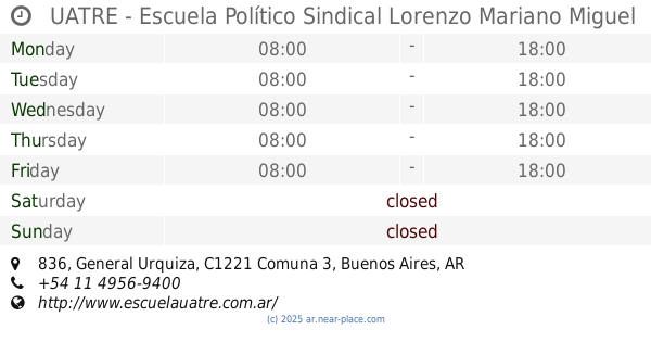
UATRE - Escuela Político Sindical Lorenzo Mariano Miguel
General Urquiza 836
School
read more
847 m
Esc. Técnica Nº 25 Tte. 1° de Artillería Fray Luis Beltrán
Avenida Jujuy 780
School
read more
894 m
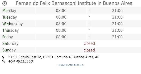
Fernan do Felix Bernasconi Institute
Cátulo Castillo 2750
School
read more
894 m
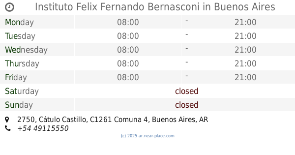
Instituto Felix Fernando Bernasconi
Cátulo Castillo 2750
School
read more
990 m
Asociacion Biblioteca Teosofica Argentina
Agrelo 3050
School
read more
1.04 km
Spat
24 de Noviembre 609
School
read more
1.077 km
Estudio Jorge Facal
Avenida Independencia 2167
School
read more
1.102 km
Instituto Nuestra Señora Del Huerto
Avenida Independencia 2140
School
read more
1.103 km
CcDxnina
Avenida Chiclana 3300, Buenos Aires
School
read more
📑
all categories
Accounting
Administrative area level 1
Administrative area level 2
Airport
Amusement park
Aquarium
Art gallery
Atm
Bakery
Bank
Bar
Beauty salon
Bicycle store
Book store
Bowling alley
Bus station
Cafe
Campground
Car dealer
Car rental
Car repair
Car wash
Casino
Cemetery
Church
City hall
Clothing store
Colloquial area
Convenience store
Country
Courthouse
Dentist
Department store
Doctor
Electrician
Electronics store
Embassy
Establishment
Finance
Fire station
Florist
Food
Funeral home
Furniture store
Gas station
General contractor
Grocery or supermarket
Gym
Hair care
Hardware store
Health
Hindu Temple
Home goods store
Hospital
Insurance agency
Intersection
Jewelry store
Laundry
Lawyer
Library
Light rail station
Liquor store
Local government office
Locality
Locksmith
Lodging
Meal delivery
Meal takeaway
Mosque
Movie rental
Movie theater
Moving company
Museum
Natural feature
Neighborhood
Night club
Painter
Park
Parking
Pet store
Pharmacy
Physiotherapist
Place of worship
Plumber
Point of interest
Police
Political
Post office
Premise
Real estate agency
Restaurant
Roofing contractor
Route
Rv park, camping
School
Shoe store
Shopping mall
Spa
Stadium
Storage
Store
Subpremise
Subway station
Supermarket
Synagogue
Taxi stand
Train station
Transit station
Travel agency
University
Veterinary care
Zoo
sublocality level 1
sublocality level 3
↑